Advertisement

We need your help now

Support from readers like you keeps The Journal open.

You are visiting us because we have something you value. Independent, unbiased news that tells the truth. Advertising revenue goes some way to support our mission, but this year it has not been enough.

If you've seen value in our reporting, please contribute what you can, so we can continue to produce accurate and meaningful journalism. For everyone who needs it.
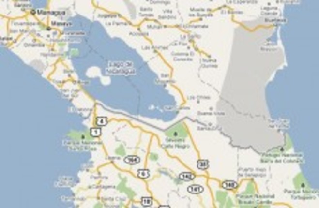
The border between Nicaragua and Costa Rica. Google Maps
Oops

Google apologises for triggering invasion

Nicaraguan general used erroneous border line on Google Map as an excuse to cross into Costa Rica.

GOOGLE HAS APOLOGISED after a mistake in one of its maps triggered a Central American invasion.

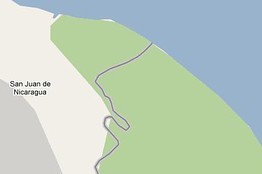
The erroneous Google Map image showed more territory belonging to Nicaragua than actually exists, according to US State Department maps of the area.

A Nicaraguan commander used the flawed map as justification for last week’s incursion into Costa Rica.

Google said that an error of up to 2.7km was marked on the map, but it was working to revise its data: “The US Department of State has provided a corrected version and we are now working to update our maps”.

The statement from Google continued:

It is our goal to provide the most accurate, up-to-date maps possible. Maps are created using a variety of data sources, and there are inevitably going to be errors in that data. We work hard to correct any errors as soon as we discover them.

The issue has been corrected on the Google Maps site.

The NY Daily News reports that Nicaraguan commander Eden Pastora used the map to justify an incursion into Costa Rica last week, and that he told La Nacion:

See the satellite photo on Google, and here you see the frontier. In the last 3,000 meters both sides are Nicaraguan. From there to El Castillo the border itself is the right bank, clearly.

InsideCostaRica reported yesterday that Nicaragua had appealed to Google not to change the map.

Costa Rica, meanwhile, has asked the Organisation of American States (OAS) to investigate the alleged invasion into its territory, according to AFP. The border has been a hotly-contested issue between the two countries since the 19th century.

[caption id="attachment_44175" align="alignnone" width="262" caption="Earlier Google Map image with the border plotted incorrectly."][/caption]