Advertisement
parliament street

260-year-old map shows plans for avenue to Dublin Castle

Dublin City Council published archived photos and pictures of old documents – this map is the oldest of them.

THE OLDEST OF Dublin city’s archived photos and materials include a map from 1757 planning to build an avenue to Dublin Castle.

Dublin City Council published an online archive this week of images of Ireland from the past 100 years, as well as photographs of memorabilia that they have in their possession.

Among the oldest pieces in their possession are 260-year-old maps proposing changes to the city centre.

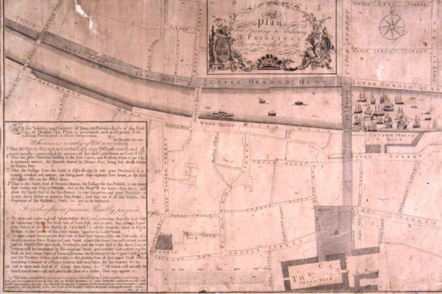
The plans (shown in the grey bits of road on the map below) were to open a principal avenue to Dublin Castle.

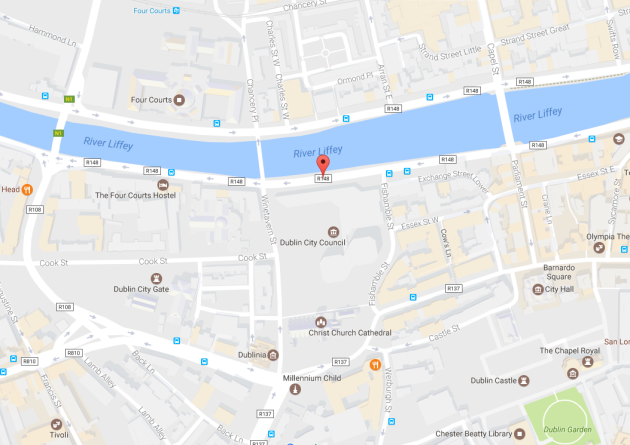
This would be the beginning of a new avenue named Parliament Street.

Plans started in 1757

Dublin City map Dublin City Library and Archive Dublin City Library and Archive

The polemic map where the plans originate (above) is attributed to George Semple, who was the architect of Essex Bridge, which is now called Grattan Bridge.

This map was distributed to members of House of Commons and Dublin City Assembly, and led directly to an Act of Parliament in 1758 to establish the Wide Street Commissioners.

In the panel on the left-hand side of the map, it lists the problems Semple felt need fixing:

That the Royal Palace or Castle is of a very difficult access and most totally concealed by means of the old Cork House on Cork Hill.
That the passage from the Castle from Essek Bridhe (a very great thoroughfare) is extremely crooked and narrow, not being more than 18 feet broad, at the end of Copper-Alley on the Blind Quay.
That at the North End of Ormond [Quay], the passage for the public is not more than 21 feet in breadth, but at the Head of King’s Inn Quay and about the North End of the Old Bridge (a very dangerous and great thoroughfare) it is only about 15 or 18 feet broad.

‘A handsome colonnade’

Dublin Map 2011

Based on the list of problems above, they list these three solutions, two of which are:

To open and make a small square before the Castle extending from the left side of Salutation Alley to the west side of Cork Hill.
To open a new street on the west side of the said little square. Fifty-one feet wide, in a direct line over Essex Bridge to Capel Street, which said direct line will extend above half an English mile in length, northerly and the South End of the direct line or avenue, will be terminated by Bermingham Tower and another gate which maybe built on that canace piece of ground between the buildings of the upper castle yard and the Treasury Office, answerable to the present gate of said upper yard, with a handsome colonnade or a plazza betwixt said two gates, for the guards.

The building of  the avenue which was completed between 1758-1762 was mainly in accordance with the 1757 plan, though a different architect was responsible.

Pictures: New online archive gives public access to Dublin’s visual history

Your Voice
Readers Comments
14
    Submit a report
    Please help us understand how this comment violates our community guidelines.
    Thank you for the feedback
    Your feedback has been sent to our team for review.