Advertisement
titanic100

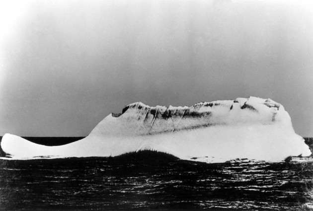
Cold mountain: This is the iceberg that sank the Titanic

The significance of this picture was only discovered long after it was taken by a seaman on another liner cruising off Newfoundland at the time Titanic sank.

THE PHOTOGRAPHIC ARCHIVE that chronicles the building, voyage and tragic sinking of the Titanic is a valuable record.

This picture – preserved by Topham Picturepoint/Press Association Images – is particularly striking. It is one of the view that show the iceberg which the Titanic ploughed into at 11.40pm on this evening 100 years ago, 14 April, 1912.

It lay at latitude 41-46N, longitude 50-14W, off the coast of Newfoundland. Newspaper reports of the time said that the visible part of the iceberg – that above the waterline – was anywhere between 50 to 100 feet high and 200 to 400 feet long.

The chief steward of the liner Prinze Adelbert took the photo of the iceberg the morning of the sinking – he spotted a line of red paint along the bottom of the iceberg, showing where it had made contact with Titanic. At the time he was not aware that it had been the iceberg that sunk the Titanic but the location, the marks on the iceberg and Titanic survivors’ descriptions of the iceberg triangulated to confirm that it was.

In pictures: Titanic launching from Southampton, 10 April, 1912>

Is Titanic based on a true story? Er, yes>

VIDEO: Final moments of the Titanic reconstructed in new animation>

7 ways to mark the Titanic centenary. Some are rather odd>

Read more Titanic articles on TheJournal.ie>

Your Voice
Readers Comments
40
    Submit a report
    Please help us understand how this comment violates our community guidelines.
    Thank you for the feedback
    Your feedback has been sent to our team for review.