Sign in. It’s quick, free and it’s up to you.
An account is an optional way to support the work we do. Find out more.
Sign in. It’s quick, free and it’s up to you.
An account is an optional way to support the work we do. Find out more.
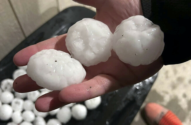
MASSIVE CHUNKS OF hail have landed on parts of Kansas and Missouri in the United States, bringing traffic to a standstill as storms unleashed possible tornadoes and meteorologists urged residents to stay indoors.
There were three unconfirmed reports of tornadoes in parts of Kansas, with reports of damaged structures.
No injuries or damage to homes has been reported, according to meteorologist Matt Wolters with the National Weather Service’s Topeka office. Survey teams planned to head out today in order to evaluate the damage, he said.
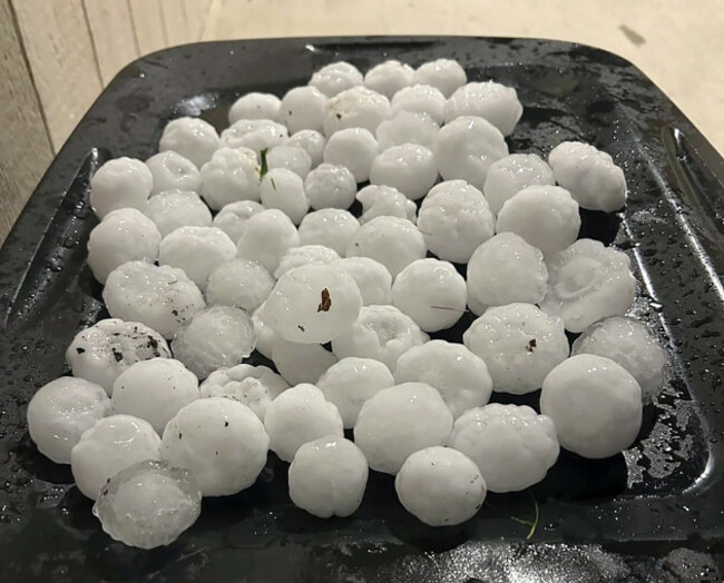
There have been reports of 10cm hail in the town of Wabaunsee in Kansas and 7.6cm hail in other parts of the state, Wolters said. Descriptions of the hail ranged from the size of golf balls and apples, to softballs and baseballs.
Alex Sosnowski, senior meteorologist at AccuWeather, previously said the predicted hail was deemed “gorilla hail” because it had the potential to be so big.
“Gorilla hail” is a term coined by Reed Timmer, a storm chaser who calls himself an extreme meteorologist. In this case, the term might fit: Some hail from north-central Kansas into north-central Missouri could be as big as a baseball.
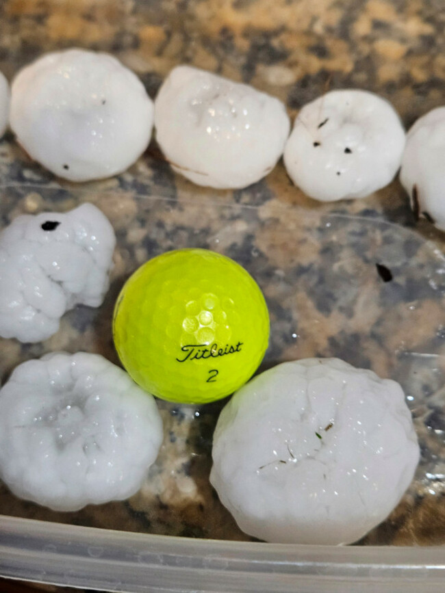
“When you get up to tennis ball, baseball-sized or god forbid softball-sized, that can do a tremendous amount of damage, and if you get hit in the head, that could be fatal,” Sosnowski said.
Traffic came to a standstill for a time on part of the major motorway in the State because of the falling hail, the National Weather Service said on X, formerly Twitter. Images of large hail chunks and at least one cracked windshield were shown on local news.

Last night, forecasters issued tornado warnings in the areas around the city of Topeka and to the north of Kansas, while severe thunderstorm warnings were issued northeast of Kansas City, in Missouri.
“If you are in this warning, get away from windows and shelter inside now!!!” the National Weather Service posted on X.
The weather service said the storm had previously produced “softball-sized hail”, or 8.9cm chunks.
The weather service also issued a severe thunderstorm watch for parts of Illinois, Iowa, Missouri and Kansas through this morning, after which forecasters said the storm would move to the east.

To embed this post, copy the code below on your site












have your say