Sign in. It’s quick, free and it’s up to you.
An account is an optional way to support the work we do. Find out more.
Sign in. It’s quick, free and it’s up to you.
An account is an optional way to support the work we do. Find out more.
LAST UPDATE | 22 Jan 2021
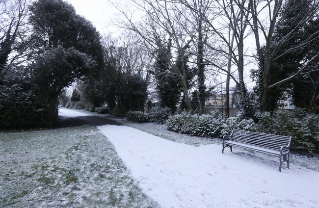
MET ÉIREANN HAS issued a Status Yellow snow/ice warning for the entire country for tomorrow night.
The warning is valid from 6pm on Saturday until 12pm on Sunday, with hail, sleet and snow expected as well as icy and hazardous conditions.
Lowest temperatures of between -3 and 0 degrees Celsius are expected.
It comes ahead of a cold and frosty weekend with a snow/ice warnings already place for 13 counties.
A Status Yellow snow/ice warning is currently in place for Cavan, Monaghan, Donegal, Leitrim, Mayo, Roscommon and Sligo. This warning will remain valid until midday tomorrow.
Met Éireann has warned that falls of hail, sleet and snow will occur in these counties and that there may also be icy and hazardous conditions.
In the North, the UK Met Office has issued Yellow Ice and Snow warning for all six counties. This warning kicks in at 4pm today and will remain valid until 10.30am tomorrow.
The Met Office has warned that snow and ice may cause travel disruption tonight and early tomorrow.
Looking at the general forecast, temperatures will drop to -3 to -1 degrees tonight with fog in some places.
Tomorrow will be another cold day, with frost lingering for much of the morning.
It will stay mostly dry, with spells of winter sunshine but scattered showers of hail, sleet and snow to continue in the northwest.
Later tomorrow evening, a band of showers in the west will turn increasingly to sleet and snow away from the coasts as it extends eastward.
Highest afternoon temperatures of just 2 to 5 degrees in a light to moderate westerly breeze.
It will be another cold day on Sunday, with sunny spells and scattered showers, mainly in the north and west where some will be of sleet or snow.
Showers will drift further inland through the afternoon and evening.
The highest temperatures will be between 3 to 5 degrees in a moderate west to southwest breeze; the lowest temperatures will be between +3 to -1 degrees.
With reporting by Hayley Halpin and Stephen McDermott.

To embed this post, copy the code below on your site


have your say