Advertisement

We need your help now

Support from readers like you keeps The Journal open.

You are visiting us because we have something you value. Independent, unbiased news that tells the truth. Advertising revenue goes some way to support our mission, but this year it has not been enough.

If you've seen value in our reporting, please contribute what you can, so we can continue to produce accurate and meaningful journalism. For everyone who needs it.
Howard Yanes/AP/Press Association Images/file
satellites

Eyes in sky help when catastrophe strikes

International agreement allows satellites to be pulled out of their orbit to monitor natural or manmade disasters.

ALMOST UNKNOWN TO the public, a constellation of satellite guardians is flying overhead, and all it takes is a phone call for them to intervene when a country is hit by a storm, earthquake, tsunami or flood.

Armed with cameras or ground radar, these Earth-observation satellites were sent into orbit for scientific and commercial missions.

But under an international agreement, they can also be called on for humanitarian work.

Assigned to fly over a disaster zone, they send back high-resolution images that can be crucial for rescue teams on the ground.

Which towns or streets are most at risk of flooding? What route can be found for relief trucks after a bridge has collapsed? And where is a secure location to pitch tents for survivors?

This pooled effort gathers 14 space agencies or national organisations, which together have 20 satellites, ranging from France’s SPOT commercial satellite to the United States’ scientific satellite, Landsat.

Their cooperation comes under an agreement called the International Charter Space and Major Disasters.

Reaction to a catastrophe

  • When catastrophe strikes, an “authorised user” of the Charter simply phones a number at the European Space Agency (ESA), where space technicians are on round-the-clock duty.
  • After confirming the request, the team looks at what satellites are available, determines which is best suited for the job and then sends a programming request to its operator.
  • Within three hours, a scout can be instructed to take pictures as it swings over the site, said Philippe Bally, ESA’s representative on the Charter’s secretariat in Paris.
  • The data is usually available within 24 hours, and the service is provided for free, rather as ships at sea divert course to pick up a seafarer in distress.

“We select the satellite according to what is needed – visual images or radar images, the type of resolution – and this is determined by the type of disaster,” said Catherine Proy of France’s National Centre for Space Studies (CNES), which devised the initiative with ESA in 1999.

“We also have to factor in differences in the time zone and overflight opportunities.”

To make the information usable on the ground, the raw data is sent to specialist cartographers, who highlight the disaster zone and compare the latest pictures against those from previous years in order to show the change.

Since 2000, the Charter has been “activated” 369 times in 110 countries.

Floods and tsunamis account for roughly half of the activations, followed by storms (16 per cent) and earthquakes (11 per cent).

The beneficiary countries are generally poor economies that do not have access to an Earth-observation satellite.

Haiti, for instance, was helped after the January 2010 earthquake with satellite pictures that pinpointed terrain that offered the best opportunities for clean water and identified areas at risk of landslip.

One of the 41 authorised users of the Charter is the United Nations, which can activate it on behalf of member states.

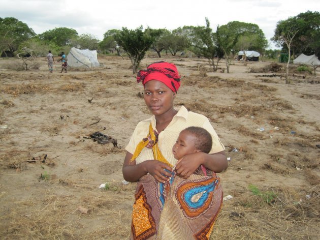
The most recent activation was after Cyclone Haruna smashed into Mozambique in February. Ireland will make its biggest donation through Irish Aid this year to Mozambique to help the country get back on its feet. This picture shows Joana Cossa and her daughter Benilda who were among 70,000 people who sought refuge in a single camp in Chiculacula after their town Chokwe was flooded out:

Image: Sarah Stack/PA Wire

Rich countries, too, can ask for an activation. Germany activated the Charter in 2003 to provide images for Iran after the 2003 Bam earthquake that left 35,000 people dead.

In November last year, parts of northern England experienced their heaviest rainfall in 50 years.

By getting satellite pictures from Germany’s TerraSAR system and Canada’s RADARSAT system, engineers on the ground were able to rush pumps to ease key locations before floodwater built up dangerously.

Diverting a satellite from a scheduled orbit entails a sacrifice for the operator, because it uses up a precious supply of onboard propellant to manoeuvre it into place.

But the Charter tries to avoid this.

With 20 satellites looping around the world in different trajectories, vast areas of the planet are covered, and one satellite is usually close enough to a disaster site to take images as it flies over. Ease of coverage will be helped after Russia joins the club.

- © AFP, 2013

Your Voice
Readers Comments
3
    Submit a report
    Please help us understand how this comment violates our community guidelines.
    Thank you for the feedback
    Your feedback has been sent to our team for review.