Sign in. It’s quick, free and it’s up to you.
An account is an optional way to support the work we do. Find out more.
Sign in. It’s quick, free and it’s up to you.
An account is an optional way to support the work we do. Find out more.
LAST UPDATE | 9 Mar 2019
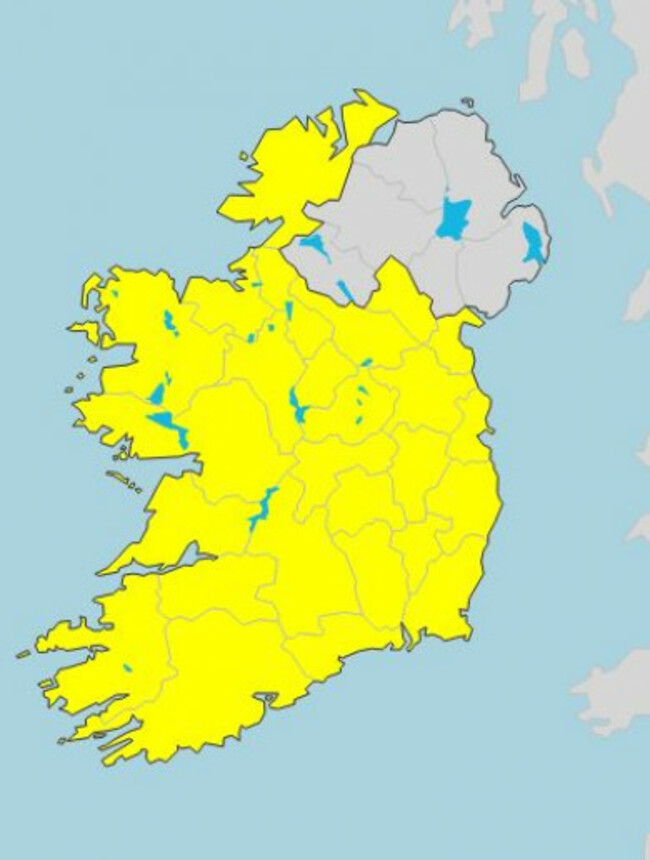
MOST OF THE country is facing sleet and snow this weekend, as Met Éireann has issued a Status Yellow warning for the entire country.
The snow-ice warning will come into effect from 11pm tonight and last into Monday morning at 6am.
Met Éireann said there would “scattered thundery showers of hail, sleet and snow expected during the period”.
It also said that there will be “poor visibility, with slippery and icy conditions”.
This warning comes after a previous that wintry showers overnight and early today would lead to snowfall accumulations of 1 to 5cm.
This warning applied to Cavan, Monaghan, Donegal, Longford, Louth, Meath, Leitrim, Roscommon and Sligo until this morning, but the new warning applies to the whole country.
Today started off blustery and windy with heavy or prolonged thundery showers. The south of the country will enjoy the driest and brightest weather today, with top temperatures between 6 and 10 degrees.
Early tonight, rain will turn to sleet and snow over much of Munster and Leinster, Met Éireann forecast. This will gradually clear overnight, but a separate band of rain, sleet and snow will move in from the west overnight.
Temperatures may also hit lows of -1 and -2 tonight.
The forecaster said that Sunday will be a “very cold day” with sunny spells and scattered showers. These showers will be confined to the west and north, with wintry downpours on higher ground.
Further ahead into next week, this period of unsettled weather is set to continue with temperatures barely getting beyond 10 and 11 degrees.

To embed this post, copy the code below on your site













have your say