Sign in. It’s quick, free and it’s up to you.
An account is an optional way to support the work we do. Find out more.
Sign in. It’s quick, free and it’s up to you.
An account is an optional way to support the work we do. Find out more.
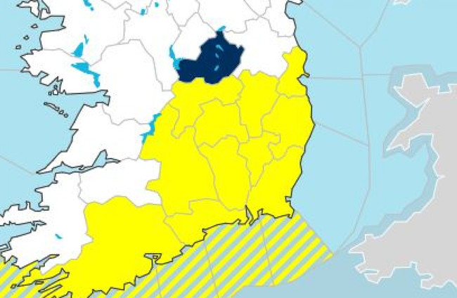
MET ÉIREANN HAS said that a status yellow thunderstorm warning issued for the south east earlier this afternoon has been lifted early.
The warning was issued for Dublin, Carlow, Kildare, Kilkenny, Laois, Offaly, Wexford, Wicklow, Cork, Tipperary and Waterford at around 2pm this afternoon and was due to remain in place until 9pm tonight.
However, Met Éireann lifted the warning earlier this evening.
Thunderstorm warning is now cancelled!
— Met Éireann (@MetEireann) July 4, 2023
There are currently no other weather warnings in operation.
The forecaster had warned that weather conditions may mean spot flooding, poor visibility and difficult travel conditions.
There were reports of flash flooding in Drogheda this afternoon, with Louth County Council reporting that a crew were onsite deploying sandbags while the local fire service pumped water. It said later that they flooding had been cleared.
Scattered showers are set to continue overnight, though many areas will remain dry, with temperatures expected to fall to between 7 and 10 degrees in mainly light westerly breezes.
Further scattered showers are expected tomorrow, which will be partly cloudy with the best of the sunny spells towards the east.
Temperatures will reach highs of 14 to 18 degrees in light to moderate westerly breezes.
Additional reporting by Jane Moore

To embed this post, copy the code below on your site













have your say