Sign in. It’s quick, free and it’s up to you.
An account is an optional way to support the work we do. Find out more.
Sign in. It’s quick, free and it’s up to you.
An account is an optional way to support the work we do. Find out more.
LAST UPDATE | 4 Jul 2021
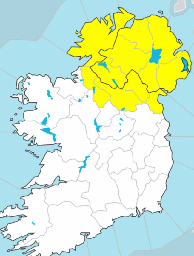
THUNDERSTORM WARNINGS ARE currently in place for 14 counties.
Met Éireann has issued a Status Yellow thunderstorm warning for Cavan, Donegal, Monaghan, Meath, Leitrim, Longford, Louth and Westmeath The warning kicked in at 2.42pm and will remain in place until 8pm this evening.
The UK’s Met Office has issued a Yellow thunderstorm warning for Antrim, Armagh, Down, Fermanagh, Tyrone and Derry. This warning kicked in at 10am and will remain in place until midnight tonight.
Looking at the general forecast, widespread heavy showers are expected throughout this afternoon and evening.
Sunshine will break through at times and it will become drier with sunny spells in the southwest during the evening.
Highest temperatures today will range between 15 and 20 degrees.
➡️Sunday Evening's Weather ⬅️
— Met Éireann (@MetEireann) July 4, 2021
🌦️⛈️Heavy showers continuing, some thundery. Risk of spot flooding, particularly across north Leinster, east Connacht and Ulster
🌥️The southwest will become drier with sunny spells
More here 👇https://t.co/9gKN6SVok4 pic.twitter.com/HjWsOQldt0
Early tonight, showers are expected to merge to give longer spells of rain in Leinster and Ulster, while it will become drier and clearer in Munster and Connacht.
Rain will continue across most of Ulster through the night.
Met Éireann says rain will be slow to clear northwards from Ulster tomorrow, with cloudier conditions there for much of the day.
Elsewhere, sunny spells and showers are forecast, with the showers becoming more frequent in the afternoon.
Highest temperatures will range between 16 and 19 degrees.

To embed this post, copy the code below on your site












have your say