Sign in. It’s quick, free and it’s up to you.
An account is an optional way to support the work we do. Find out more.
Sign in. It’s quick, free and it’s up to you.
An account is an optional way to support the work we do. Find out more.
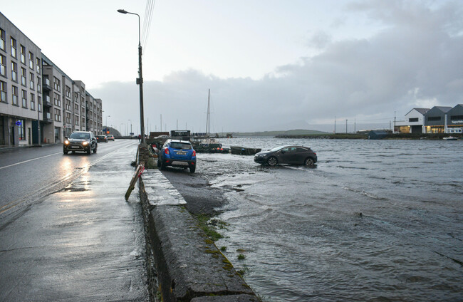
CORK AND WATERFORD City and County Councils have warned of possible flooding today and tomorrow due to a combination of heavy rain and higher than usual tides.
Met Éireann has issued a Status Yellow rain warning for Co Kerry from 2pm until 8pm today and warned that the area will be “wet and windy with localised flooding and highest accumulations in mountainous regions”.
Kerry County Council has told The Journal it is “closely monitoring the situation in areas which are prone to flooding”.
Heavy rain is expected along southern Munster, which will be made worse by a period of sea surge on top of very high astronomical Spring Tides.
⚠️Flood Warning for 21-23 March
— Cork City Council (@corkcitycouncil) March 20, 2023
⬅️Cork City Council wish to advise that there will be a period of high astronomical Spring tides in the coming days
🅿️Some roads & parking areas along low-lying quays in the city centre may flood
👨💻For full info: https://t.co/Zey7cAu95D pic.twitter.com/YCLulfJOzM
Spring Tides occur twice each lunar month when tides appear to “spring forth” due to the position of the sun and moon enhancing the gravitational effect that causes tides.
This means that high tides are a little higher than average and low tides are a little lower than average.
Met Éireann has also warned of south to southwest winds off the entire coast which are expected to increase to gale force 8.
A Status Yellow warning will be in place for Donegal in the early hours of Wednesday morning due to high wind and possible coastal flooding.
Cork City Council have urged members of the public to stay away from the following areas:
Morrison’s Quay, Fr Matthew Quay, Trinity Bridge, Union Quay, Sharman Crawford Street, Wandesford Quay, Frenche’s Quay, Proby’s Quay, Crosses Green, Lavitt’s Quay, Kyrl’s Quay, South Terrace, Rutland Street and Sawmill Street.
High tide will occur at 5.30pm this evening, 5.50am tomorrow morning, 6.15pm tomorrow evening, 6.35am on Thursday and 6.50pm on Thursday evening.
With localised flooding anticipated, Waterford City and County Council has said it will deploy flood barriers in Waterford City and Passage East.
The council has advised the public to stay away from exposed piers, harbours and sea walls as there is a risk of wave over-topping and have closed four carparks that were at risk of flooding until 8am tomorrow as a precaution.

To embed this post, copy the code below on your site













have your say