Sign in. It’s quick, free and it’s up to you.
An account is an optional way to support the work we do. Find out more.
Sign in. It’s quick, free and it’s up to you.
An account is an optional way to support the work we do. Find out more.
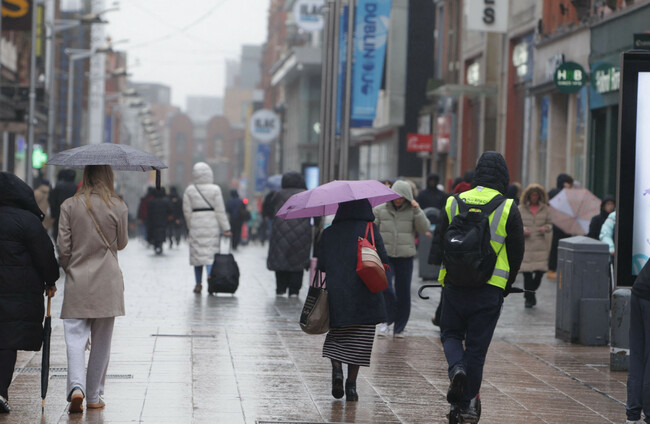
A STATUS YELLOW rain warning is in place for some 17 counties this morning, with warnings that more flooding may follow due to the saturated ground.
Met Éireann has placed all of Leinster – and counties Cavan, Monaghan, Cork, Tipperary and Waterford – under a rain warning until 11pm tonight.
The high river levels will lead to flooding, poor visibility and difficult travelling conditions, the forecaster said.
Elsewhere, five other counties are under a Status Yellow wind warning, with a separate rain/snow warning in effect in Donegal.
The national forecaster has said the weather could lead to difficult travelling conditions in places, with fears it could bring transport and travel disruption for commuters this morning.
Updates by Jane Moore.
Good morning and welcome to our latest liveblog on the weather.
Jane Moore here – and I regret to inform you that it is, in fact, raining again.
With three weather warnings in place and Met Éireann warning of possible travel disruption, I’ll be bringing you any and all related updates throughout the morning.
The three Status Yellow warnings came into effect last night.
The rain warning for Leinster, Cavan, Monaghan, Cork, Tipperary and Waterford is due to remain in place until 11pm.
Met Éireann has warned that rain falling on already saturated ground combined with high river levels will lead to flooding, poor visibility and difficult travelling conditions.
The wind warning is in place for counties Wexford, Wicklow, Dublin, Meath and Louth and will remain in effect until 1pm.
Strong and gusty southeasterly winds combined with high tides may lead to wave overtopping, fallen trees and difficult travelling conditions, according to Met Éireann.
Meanwhile, a separate rain/snow warning for Donegal will be in place until 2pm.
The forecaster said heavy rain could turn to sleet or snow, which could lead to poor visibility and difficult travelling conditions.
A rain and snow warning is also in place for all of Northern Ireland until 8pm.
Yesterday, the National Directorate for Fire and Emergency Management convened a meeting of local authorities, Met Éireann, a number of government departments, state agencies and utility providers to prepare for the incoming heavy rain and associated flooding risk.
The group said in a statement that there is the possibility of some wintry precipitation, such as sleet, in the northwest and over high ground in Wicklow.
It added that heavy rainfall is expected throughout today, with the highest totals forecast for the south, east, northeast, and midlands – this additional rainfall may trigger further flooding, given current ground and river conditions.
“Whether or not a yellow rain warning is in place for a county, all areas will remain at risk of flooding,” the group said.
Met Éireann‘s Rebecca Cantwell says – unsurprisingly – that we’re in for a wet and breezy day, with the rain turning heavy at times and possibly falling as sleet and snow for a time.
The east will get the majority of the heavy rain, with scattered showers following to western areas.
Take a listen to the latest audio forecast.
📢 Hear the latest National Audio Forecast from Met Éireann for today and the coming days.
— Met Éireann (@MetEireann) February 18, 2026
Listen now ⬇️ pic.twitter.com/DIBvC8q78G
There are reports of surface water on the M50 near Dún Laoghaire, with motorists advised to check updates on road conditions before travelling.
Met Éireann’s Rebecca Cantwell said the eastern half the country is going to see the highest accumulations of rainfall yet again.
Speaking on RTÉ’s Morning Ireland in the last few minutes, she said the rain is expected to clear western areas by the early afternoon, while the east is at risk of surface and river flooding.
The rainfall will be worst on higher ground in the east, such as the Wicklow Mountains, while the wind will also be strongest along the east coast.
“The rain will really pick up through the morning and afternoon, with the heaviest expected to fall then as the winds are picking up too, so just bear that in mind,” she said.
Some slight good news, though: Cantwell said Met Éireann does not anticipate that the Yellow warnings will need to be upgraded.
“Of course, we’re going to keep an eye on the situation, but totals are kind of topping up as expected,” she said. “Unless something changes dramatically, it’s not looking likely at the moment.”
So far, rainfall in the east of the country in February has been over 200% of the long-term average, she said.
“In contrast, in the west where we’d expect the worst rainfall, only 34% of the long term average has been seen in Belmullet,” she added.
Public transport appears to be operating relatively smoothly so far this morning.
Iarnród Éireann says DART services are operating with minor delays, while it seems only one rail service is experiencing disruption unrelated to the weather.
The 07.05 Drogheda/Bray is operating at a reduced capacity “due to vandalism”, the operator said.
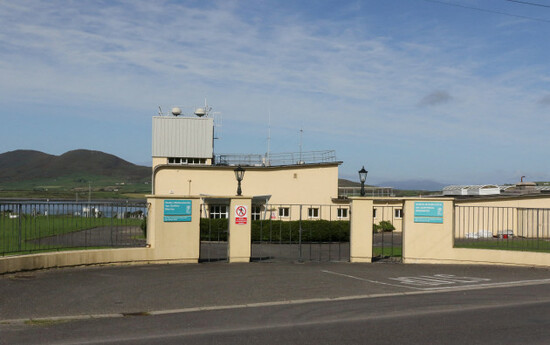
It has rained every day of 2026 so far at one weather station.
Valentia Observatory in Co Kerry has seen 47 consecutive days of rain, according to Met Éireann.
The forecaster defines a “rain day” as a day on which rainfall of 0.1mm or more is recorded.
The last day where there was zero rainfall in Ireland was 50 days ago on 29 December.
Congestion Report:
— TII Traffic (@TIITraffic) February 18, 2026
M50 Southbound: J03 - J13.
Delays on routes around Dublin: M1 (S), N2 (S), M3/N3 (S), M4/N4 (E), N7 (E) & M11/N11 (N).
Drive with care!#TII #Slowdown pic.twitter.com/gbkp1JaV8e
As we approach 8am, there have been no reports of flooding around the country so far.
However, the rain is going to be falling all day, and with it set to become heavier and coincide with high tide, Met Éireann’s warning that some areas in the east could see flooding is still to be heeded.

Well, it appears that so far, the weather hasn’t quite had the impact we thought it would when we began this liveblog this morning…
We’re going to wrap things up for the moment – but we’ll be back later to bring you any and all updates should conditions get worse.
For now, here are the main points you need to know:

To embed this post, copy the code below on your site
















have your say