Sign in. It’s quick, free and it’s up to you.
An account is an optional way to support the work we do. Find out more.
Sign in. It’s quick, free and it’s up to you.
An account is an optional way to support the work we do. Find out more.
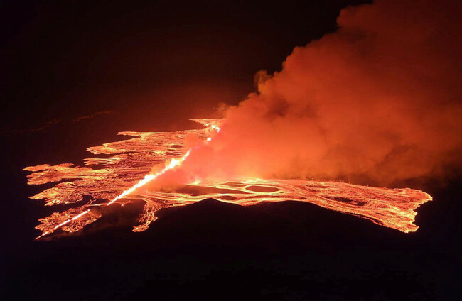
A STATE OF emergency has been declared in Iceland following a volcanic eruption on the Reykjanes peninsula, the fourth eruption to hit the area since December.
A volcanic eruption “started between stora Skogfell and Hagafell on the Reykjanes Peninsula,” said a statement from the Icelandic Met Office (IMO). Live video images showed glowing lava and billowing smoke.
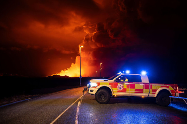
Iceland’s department of civil protection and emergency management announced it had sent a helicopter to narrow down the exact location of the new fissure. The authority also said the police had declared a state of emergency due to the eruption.
RUV, the Icelandic national broadcasting service, quoted geophysicist Magnus Tumi Gudmundsson as saying that the latest eruption is the most powerful so far.
According to the IMO, it occurred close to the same location as a previous eruption on 8 February. Lava appeared to flow south towards the dykes built to protect the fishing village Grindavik, it said.
Just after 10pm last night, “the southern lava front was just 200 metres from the barriers on the eastern side of Grindavik and moving at a rate of about one km per hour,” it added.
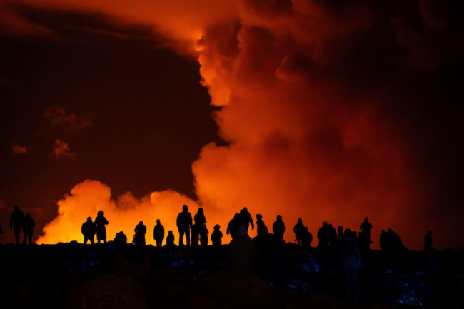
Local media reported that the country’s famed Blue Lagoon geothermal spa had been evacuated as well as Grindavik.
No flight disruptions were reported at nearby Keflavik, Iceland’s main airport.
Lava was also flowing west, as it had on 8 February, and the length of the fissure was estimated to be 2.9 kilometres, said the IMO.
“From initial assessments of web camera imagery and aerial photographs from the helicopter flight, the eruption is thought to be the largest (in terms of magma discharge) of the three previous fissure eruptions from the Sundhnukur crater row,” IMO said, stressing the assessment was based on the first hour of “eruptive activity.”
Minutes before the eruption, the agency had issued a statement saying that seismic activity indicated that there was an increased chance of an eruption.
“The pre-eruptive warning phase was very short,” the IMO said.
The IMO had warned for weeks that magma was accumulating under the ground, making an eruption likely.
The roughly 4,000 residents of Grindavik were only cleared to return to their homes on 19 February after having been evacuated on 11 November, though only around a hundred chose to do so.
On that occasion, hundreds of tremors damaged buildings and opened up huge cracks in roads.
The quakes were followed by a volcanic fissure on 18 December that spared the village.
But a fissure opened right on the town’s edge, in January, sending lava flowing into the streets and reducing three homes to ashes, followed by a third eruption near the village on 8 February.
As of Friday, more than 300 of Grindavik’s inhabitants had put in requests to sell their house to the state.
The eruptions on the Reykjanes peninsula have also raised fears for the Svartsengi power plant, which supplies electricity and water to around 30,000 people on the Reykjanes peninsula.
The plant was evacuated and has been run remotely since the first eruption in the region, and dykes have been built to protect it.
Iceland is home to 33 active volcano systems, the highest number in Europe.
It straddles the Mid-Atlantic Ridge, a crack in the ocean floor separating the Eurasian and North American tectonic plates.
But until March 2021, the Reykjanes peninsula had not experienced an eruption for eight centuries.
Further eruptions occurred in August 2022 and in July and December 2023, leading volcanologists to say it was probably the start of a new era of seismic activity in the region.
With reporting from © AFP 2024

To embed this post, copy the code below on your site











have your say