Sign in. It’s quick, free and it’s up to you.
An account is an optional way to support the work we do. Find out more.
Sign in. It’s quick, free and it’s up to you.
An account is an optional way to support the work we do. Find out more.
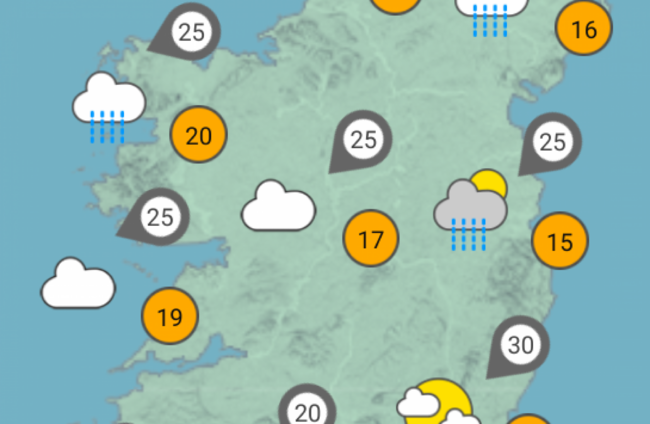
MORE RAIN AND spot flooding are on the way in the coming days but it will also be quite warm and humid.
Today will be generally cloudy or dull with showery spells of rain, heaviest in the north and east, according to Met Éireann.
Long dry spells will develop, but heavy thundery rain will begin to move into the southeast later this evening.
Highest temperatures will range from 14 to 20 degrees Celsius, mildest in the west and northwest where some brighter spells will develop.
It will also be breezy with northeast winds, making it feel cool along Irish Sea coasts.
Long dry spells will occur across Ulster and Connacht tonight. However, showers or possibly thundery rain will continue to push up from the southeast, affecting much of Leinster and Munster overnight.
Lowest temperatures will range from nine to 12 degrees Celsius.
Spot flooding
There will be some sunny spells tomorrow, but overall it will be cloudy with scattered showers and light northeast breezes.
The showers are likely to be heaviest across the northwest, south Leinster and south Munster. It’s expected to be warm and humid with highest temperatures of 17 to 21 or 22 degrees.
Many areas will be dry tomorrow night, but some heavy showers will persist across southern counties. It will be mild and humid with lowest temperatures 10 to 13 degrees Celsius.
Sunday is due to be warm and humid with sunshine and slow moving heavy showers. Prolonged thundery downpours will occur, especially across the western half of the country with spot flooding and local hail.
Highest temperatures will range from 18 to 23 degrees Celsius, in mostly light westerly breezes.
It will be humid overnight with further showers or longer spells of thundery rain, mainly across the north and west. Lowest temperatures will range from 11 to 14 degrees.

To embed this post, copy the code below on your site















have your say