Sign in. It’s quick, free and it’s up to you.
An account is an optional way to support the work we do. Find out more.
Sign in. It’s quick, free and it’s up to you.
An account is an optional way to support the work we do. Find out more.
THE MOST POWERFUL storm to ever travel this far east in the Atlantic Ocean (according to records) is due to hit Ireland.
Met Éireann has warned that ex-Hurricane Ophelia is expected to be the most severe weather event to hit the island of Ireland in over 50 years and a status red alert wind warning has been issued for the entire country.
You can keep up to date with the transport and traffic news here – and we’ll have minute-by-minute updates in our liveblog here.
Here’s how Hurricane Ophelia gained power in recent days:
The beginning
Ophelia officially gained hurricane status last Wednesday and quickly intensified into a Category 3 hurricane on Thursday – this was the sixth major hurricane of the Atlantic season.
As of midday Saturday, Ophelia was around 2,500km southwest of Ireland and 500km southwest of Portugal’s Azores islands.
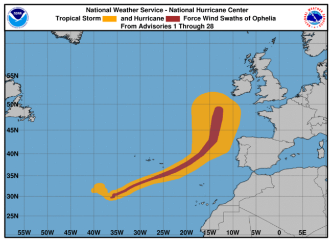
The storm dumped heavy rains on the islands over the weekend, and while seven of the nine islands were on high alert for the storm’s passage, it did not cause major damage.
Over the weekend, Hurricane Ophelia underwent an “extra-tropical transition”, according to Met Éireann.
That means that its structure and appearance changed drastically as it approached Ireland – it lost its hurricane status but it became a powerful extra-tropical storm.
The storm was hit with an upper trough of low pressure at it passed the mid-Atlantic, which caused the storm system to accelerate towards Ireland and the UK.
As the storm moved north towards Ireland, it met cooler seas and westerly winds. The winds increased the storm in strength and height.
Met Éireann says this is a phenomenon known as a vertical wind shear. The shear cuts off the upper part of a hurricane and sweeps it away.
What remained was the ex-hurricane’s low-level circulation which became the focus point for further development.
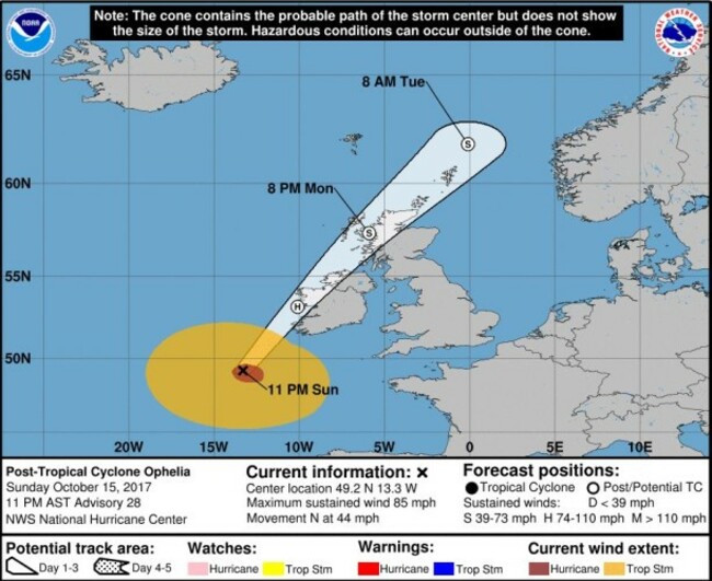
Yesterday afternoon, the US National Hurricane Center lowered the storm’s status to a Category 1.
However, Ophelia sustained winds at 140km/h with higher gusts.
Met Éireann announced a status red warning for the whole of Ireland last night.
This morning
At 3am, the National Hurricane Center said that the ex-hurricane was moving towards Ireland at around 70km/h.
Ophelia is expected to reach the west coast of Ireland by 10am this morning. The storm is forecast to track directly over Ireland during daytime hours.
This is what it looked like as of 8am this morning:
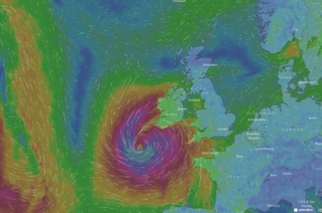
According to Met Éireann “violent and destructive gusts” are forecast. All areas of the country at risk, with heavy rain and storm surges expected.

To embed this post, copy the code below on your site














have your say