Advertisement

We need your help now

Support from readers like you keeps The Journal open.

You are visiting us because we have something you value. Independent, unbiased news that tells the truth. Advertising revenue goes some way to support our mission, but this year it has not been enough.

If you've seen value in our reporting, please contribute what you can, so we can continue to produce accurate and meaningful journalism. For everyone who needs it.
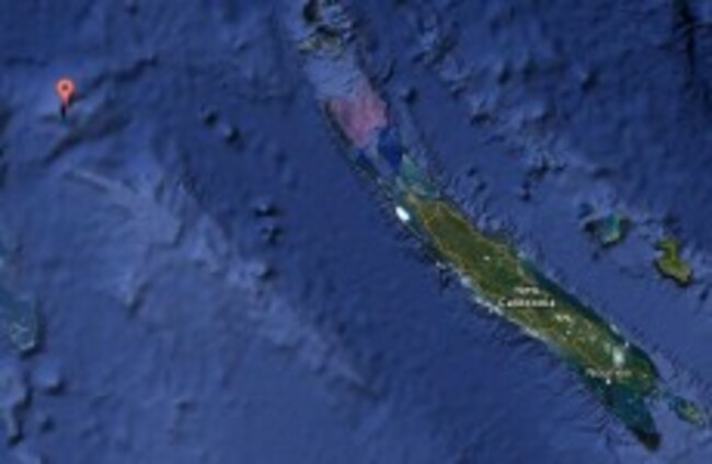
'A' marks the spot where Sandy Island lies on Google Maps. Google Maps
missing island

Scientists can't find Pacific island called Sandy

“It’s on Google Earth and other maps so we went to check and there was no island. We’re really puzzled. It’s quite bizarre,” said the explorer.

A SOUTH PACIFIC island identified on Google Earth and world maps does not exist, according to Australian scientists who went searching for the mystery landmass during a geological expedition.

The sizeable phantom island in the Coral Sea is shown as Sandy Island on Google Earth and Google Maps and is supposedly midway between Australia and the French-governed New Caledonia.

The Times Atlas of the World appears to identify it as Sable Island. Weather maps used by the Southern Surveyor, an Australian maritime research vessel, also say it exists, according to Dr Maria Seton.

But when the Southern Surveyor went to where the island was supposed to be it was nowhere to be found.

Seton, from the University of Sydney, said it was very perplexing:

It’s on Google Earth and other maps so we went to check and there was no island. We’re really puzzled. It’s quite bizarre.

How did it find its way onto the maps? We just don’t know, but we plan to follow up and find out.

News of the invisible island sparked debate on social media, with tweeter Charlie Loyd pointing out that Sandy Island is also on Yahoo Maps as well as Bing Maps “but it disappears up close”.

Someone else debated that many mapmakers put in deliberate but unobtrusive and non-obvious ‘mistakes’ into their maps so that they can know when somebody steals the map data.

Google said it always welcomed feedback on a map and “continuously explores ways to integrate new information from our users and authoritative partners into Google Maps”.

The Australian Navy’s Hydrographic Service — the department responsible for producing official nautical charts — told Fairfax media it took the world coastline database “with a pinch of salt” since some entries were old or erroneous.

- © AFP, 2012

Read: 21 of the best photos from the Macy’s Thanksgiving Day Parade >

Your Voice
Readers Comments
48
    Submit a report
    Please help us understand how this comment violates our community guidelines.
    Thank you for the feedback
    Your feedback has been sent to our team for review.