Advertisement

We need your help now

Support from readers like you keeps The Journal open.

You are visiting us because we have something you value. Independent, unbiased news that tells the truth. Advertising revenue goes some way to support our mission, but this year it has not been enough.

If you've seen value in our reporting, please contribute what you can, so we can continue to produce accurate and meaningful journalism. For everyone who needs it.
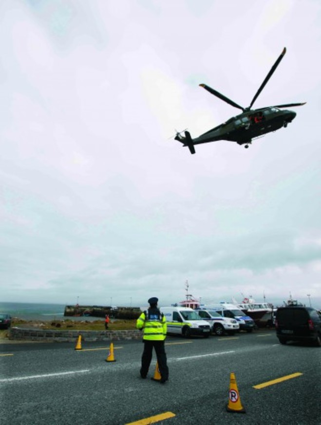
RTÉ's Prime Time revealed that concerns had been raised about the terrain warning system in 2013. Eamonn Farrell/Rollingnews.ie
Search and Rescue

Pilot flagged concerns that island was not on mapping system 4 years before Rescue 116 crash

A report on RTÉ’s Prime Time detailed a series of emails between pilots and the search and rescue operator in 2013.

A PILOT HAD raised concerns four years ago that Black Rock island off Mayo was not on the onboard warning systems that Coast Guard search and rescue teams use, but no action was taken.

A report on RTÉ’s Prime Time this evening detailed these issues were flagged well before Rescue 116 went down in March.

Captain Dara Fitzpatrick was recovered at sea soon after the helicopter went down, but died later in hospital. The body of pilot Mark Duffy was found in the wreckage of the helicopter some weeks later.

The bodies of winch operator Paul Ormsby (53) and winchman Ciarán Smith (38) have yet to be recovered.

Search and Rescue

The Coast Guard’s Search and Rescue service is run by private operator, CHC Ireland, which won a 10-year €500 million contract to provide the service in 2012.

Each helicopter has been equipped with an enhanced ground proximity warning system (EGPWS) since 2013.

This system is designed to warn pilots to take appropriate action to avoid a collision if they get too close to terrain or some obstacle.

The EGPWS can only work when it has a complete map of the terrain and obstacles. Black Rock island was not on this system.

The crew on board Rescue 116 did not receive the warning about the island until it was too late.

Prime Time found a chain of emails between Sligo-based Coast Guard pilots and a senior CHC manager dating back to 2013, in which the omission of Black Rock on the system was flagged.

A source quoted in the programme said that the pilot had spotted the omission while carrying out a test flight.

Information passed on

That source said that Coast Guard personnel were told at a meeting six weeks after the Rescue 116 crash that management was trying to establish if this information had been passed on to the company that supplied the EGPWS system.

That company – called Honeywell – told RTÉ that it couldn’t comment due to the ongoing investigation into the crash.

A spokesperson for CHC also said the company could not comment on this specific case, but said that it has “multiple systems and programmes that encourage employees to report any safety concerns”.

There were also claims that the EGPWS provided inaccurate data on other terrains around Ireland, including Skellig Michael off Kerry.

That data was provided by the Irish Aviation Authority, and it said that it only learned that its data for Skellig Michael was incorrect nine days after the Rescue 116 crash.

Until 24 March this year, the official IAA aeronautical map had the island at just 174 feet high. That is in fact the height of the lighthouse on the island. Its actual height is 712 feet.

The IAA has since issued a revised map.

Read: ‘A local man. A hero. A friend’ -Locals plan lasting memorial for missing Coast Guard crewman

Read: ‘We’re gone’: Final words of R116 crew released in preliminary report

Your Voice
Readers Comments
34
    Submit a report
    Please help us understand how this comment violates our community guidelines.
    Thank you for the feedback
    Your feedback has been sent to our team for review.