Readers like you keep news free for everyone.
More than 5,000 readers have already pitched in to keep free access to The Journal.
For the price of one cup of coffee each week you can help keep paywalls away.
Readers like you keep news free for everyone.
More than 5,000 readers have already pitched in to keep free access to The Journal.
For the price of one cup of coffee each week you can help keep paywalls away.
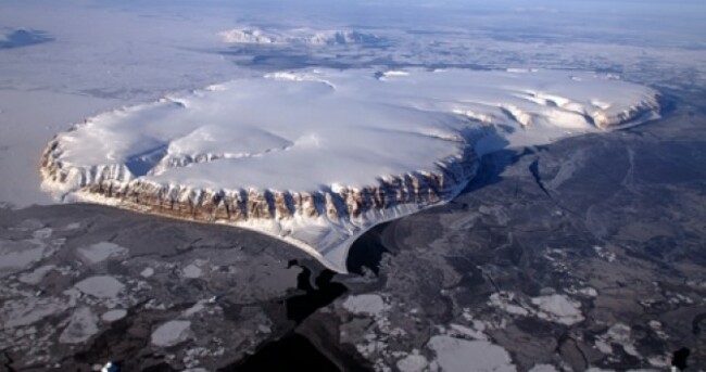
NASA IS CURRENTLY undertaking the largest-ever airborne survey of the planet’s polar regions — known as Operation IceBridge. The US space agency’s P-3B aircraft have been tasked with collecting radar, laser altimetry and other data on the changing ice sheets of the Arctic and Antarctic circles.
The cockpit- and rear-mounted on-board cameras have also captured stunning vistas of some of the most remote regions on the globe: the sequence below shows highlights from the programme’s springtime flights over Greenland and the Arctic Ocean.
(Youtube: NasaExplorer)
Each area is surveyed yearly using an array of instrumentation, and its planned the data collected will be used to produce what NASA describe as an “unprecedented three-dimensional view of Arctic and Antarctic ice sheets, ice shelves and sea ice”. According to the agency’s mission statement:
NASA’s Operation IceBridge images Earth’s polar ice in unprecedented detail to better understand processes that connect the polar regions with the global climate system.In addition, IceBridge collects critical data used to predict the response of earth’s polar ice to climate change and resulting sea-level rise. IceBridge also helps bridge the gap in polar observations between NASA’s ICESat satellite missions.
The Greenland flights are conducted in March-May of each year, with the surveys of Antarctica taking place in in October-November. Other smaller airborne surveys also take place around the world.
(Image: NASA/IceBridge)
To embed this post, copy the code below on your site