Sign in. It’s quick, free and it’s up to you.
An account is an optional way to support the work we do. Find out more.
Sign in. It’s quick, free and it’s up to you.
An account is an optional way to support the work we do. Find out more.
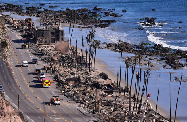
LOS ANGELENOS HAVE been anxiously waiting for the wildfires wreaking devastation to abate – but strong winds sweeping over the city that fuel the fires have grown stronger.
The Santa Ana winds, also known as the “Devil” winds, come from inland neighbouring states and bring masses of hot, dry air that create the conditions for intense wildfires and fuel them while they are underway.
The winds can dry out vegetation, allowing sparks to catch more swiftly, and then further fan the blazes once they are burning.
As the fires took hold last week, authorities hoped that a break in the winds expected a the weekend could be the opportunity needed for firefighters to get the upper hand.
There was a brief lull in the winds on Friday and Saturday and firefighters were able to extinguish three of the smaller fires that were burning.
However, the heavy winds quickly picked back up again and the 23,700-acre Palisades Fire and 14,000-acre Eaton Fire – the largest of the fires – continued to rage. By Sunday, there were gusts of up to 110 kilometers per hour.
The US’s National Weather Service (NWS) has issued a “Particularly Dangerous Situation” warning from 4am local time today until noon tomorrow. Forecasters said “extremely critical” conditions were developing, with winds already gusting to 120 kilometres per hour in parts of Los Angeles and Ventura counties.
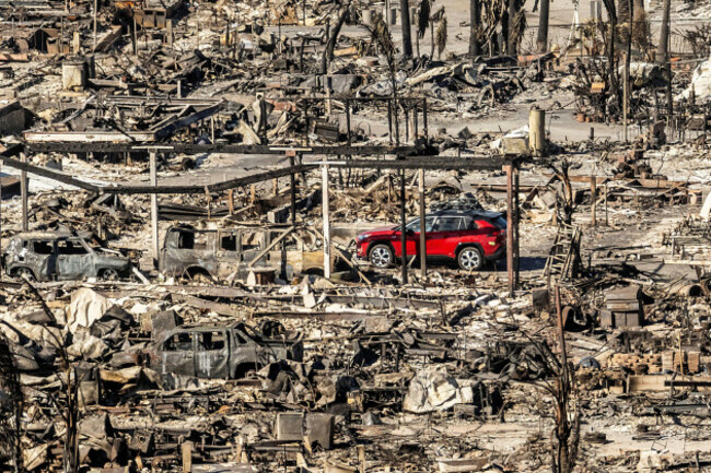
The strength of the winds combined with very dry relative humidities and dry fuels “will result in extremely critical fire weather conditions, as forecast by the Storm Prediction Center”, the NWS said.
“Not only will these extreme and dangerous conditions make fighting ongoing fires much more difficult but these will make new ignitions much more likely,” it warned.
“New fires that do develop will have the potential to grow and spread rapidly, adding to the danger of the situation.”
The Washington Post has compared Santa Ana winds to “a giant hair dryer”, while American author Raymond Chandler once labelled them so hot they “curl your hair and make your nerves jump and your skin itch”.
Successive Santa Ana winds in 2017 fuelled a blaze known as the Thomas Fire, which destroyed more than 1,000 structures.
These specific wind patterns typically happen between September and May for a few days at a time when high-pressure weather systems form over the deserts east of California and gain heat and lose moisture as they move westwards.
Part of the horror of the current wildfires has been how unexpected they were at this time of year.
As climate change escalates, California is growing hotter and its weather, like other places, is becoming more unstable. It experienced significant rainfall in the first half of 2024 but that was swiftly followed by a prolonged period of drought.
Additional reporting by AFP
Unsure of what exactly is happening with the earth’s climate? Check out our new FactCheck Knowledge Bank for essential reads and guides to finding good information online.

To embed this post, copy the code below on your site











have your say