Sign in. It’s quick, free and it’s up to you.
An account is an optional way to support the work we do. Find out more.
Sign in. It’s quick, free and it’s up to you.
An account is an optional way to support the work we do. Find out more.
Updated 12.15pm
ICELAND’S MET OFFICE has raised its aviation warning to red after a fissure eruption close to the Bardarbunga volcano.
Authorities initially closed the airspace up to 5,000 feet in the area of the eruption, which began just after midnight after cracks and sinkholes were observed in the ice surrounding the volcano.
However, the airspace has since reopened, AFP stated.
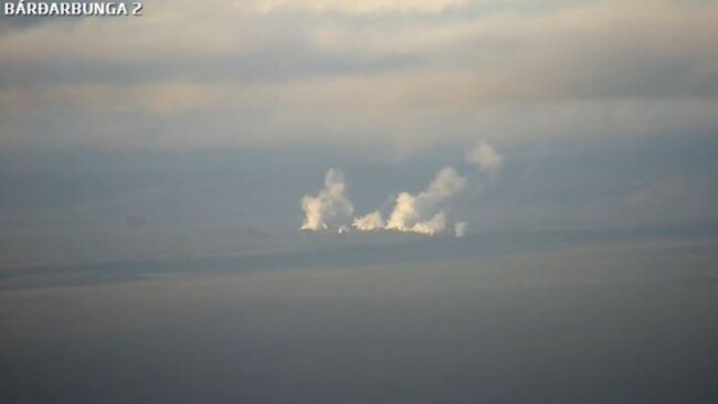
This image was taken at 7.34am via the Mila webcam livestream of the eruption:
The Icelandic Met Office made the following announcement in English on its Facebook page:
An eruption started in Holuhraun north of Dyngjujökull at around 00:02.
Seismic tremor was observed on all seismic stations and the web camera installed in the area by Mila has showed some nice pictures of the eruption.
It is a small fissure eruption and at 02:40 AM the activity appears to have decreased. #bardarbunga
According to Iceland’s Air Navigation Service, ISAVIA, the eruption has produced lava flow, but relatively little airborne ash.
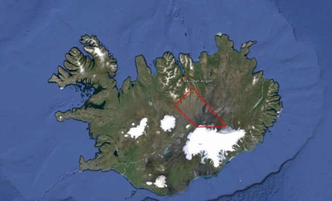
As a result, only a 10-nautical mile radius above the Bardarbunga volcano system, and up to 5,000 ft, is currently closed – as shown in this satellite image:
On Wednesday, the University of Iceland posted this aerial image of the new cracks at Holuhraun, next to the Bardarbunga volcano, which came to a head with last night’s eruption.
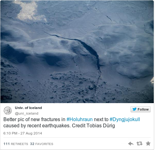 Univ. of Iceland / Twitter
 / Twitter
Univ. of Iceland / Twitter
Univ. of Iceland / Twitter / Twitter
The Bardarbunga volcano system was hit by a 5.7 magnitude earthquake on Tuesday, the most powerful in 18 years, raising fears of a destructive eruption that might disrupt air traffic over Iceland.

To embed this post, copy the code below on your site














have your say