Sign in. It’s quick, free and it’s up to you.
An account is an optional way to support the work we do. Find out more.
Sign in. It’s quick, free and it’s up to you.
An account is an optional way to support the work we do. Find out more.
EUROPE IS FACING into yet another heatwave this coming week as a heat dome is expected to form over parts of western Europe.
The areas underneath the forecast heat dome include southern France and the Iberian Peninsula, where temperatures are expected to reach the mid to high thirties.
Temperatures in southern England are predicted to reach the mid twenties while countries like Belgium and the Netherlands can expect similar.
These are anomalous temperatures considering Europe is heading into the second month of Autumn.
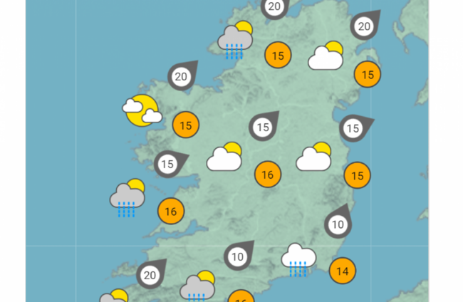
Temperatures in Ireland will not be reaching those highs this week but Met Éireann is forecasting highs in the mid teens with mostly dry conditions and occasional showers.
Tomorrow, the national forecaster says “there will be plenty of dry weather across the country with a mix of cloud, hazy sunny spells and a few passing showers.
“However, it will be cloudier in the southeast with the chance of persistent rain developing there for a time, mainly at the coast.”
Highest temperatures tomorrow will be between 13 to 16 degrees with a moderate southwest breeze.
The outlook is similar for the rest of the week with mainly dry conditions forecast along with high temperatures of between 14 and 17 degrees.
The warm weather is also predicted to carry over into next weekend.

To embed this post, copy the code below on your site
















have your say