Sign in. It’s quick, free and it’s up to you.
An account is an optional way to support the work we do. Find out more.
Sign in. It’s quick, free and it’s up to you.
An account is an optional way to support the work we do. Find out more.
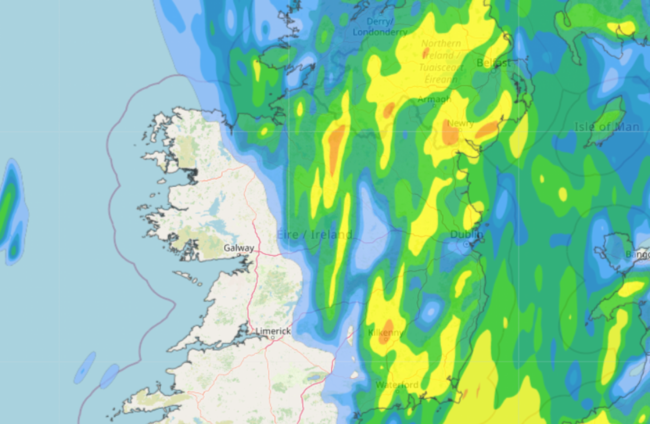
MET ÉIREANN HAS issued a Status Yellow rain warning for Co Louth as last night’s heavy rain moves towards the east of the country.
The national forecaster has said the county can expect heavy rain with the possibility of a few thundery downpours.
It warned that the weather could cause localised flooding and difficult travelling conditions.
Status Yellow rain warnings were also issued for counties Wicklow, Wexford, Kilkenny and Carlow. These warnings expired this morning.
Yesterday several southern counties were advised to expect heavy rain, with Cork and Waterford placed under a Status Orange rain warning. The warning expired this morning at 5am.
Meanwhile, Northern Ireland is also impacted by heavy rains. Counties Antrim, Armagh and Down are under Status Yellow rain warnings until 12pm today.
The national forecaster said that today, outbreaks of rain, heavy at times, will continue to clear northeastwards this morning.
Drier and brighter conditions are expected by the early afternoon with a mix of sunshine and a few showers.
Some of the showers will turn heavy or possibly thundery later, mainly in Munster.
The temperature is expected to rain highs of 17 degrees.
Tonight will bring a mix of clear spells and showers. The showers will merge to longer spells of rain at times, especially over the southern half of the country, where some heavy and thundery downpours are possible.
Temperatures are expected to reach lows of seven degrees.
Tomorrow will see a cloudy start with scattered showers, merging to longer spells of rain at times, especially near the east coast.
Some heavy bursts and isolated thunderstorms are possible but they will ease towards the evening.
Highest temperatures of 16 degrees are expected.

To embed this post, copy the code below on your site















have your say