Sign in. It’s quick, free and it’s up to you.
An account is an optional way to support the work we do. Find out more.
Sign in. It’s quick, free and it’s up to you.
An account is an optional way to support the work we do. Find out more.
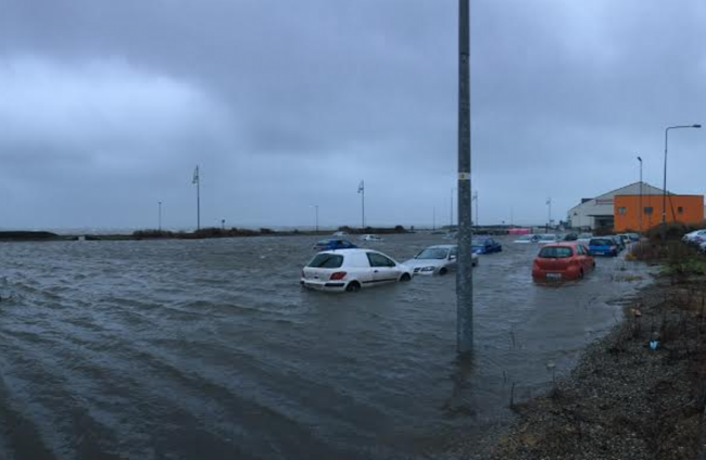
STRONG WINDS AND torrential rainfall swept across much of the country yesterday as Met Éireann issued three status yellow weather alerts.
But calmer weather is expected today with rain clearing northeastwards this morning, and gales on southern and eastern coasts easing.
The wind advisory for Dublin, Wexford, Wicklow, Galway, Clare, Cork, Kerry, Limerick and Waterford, as well as the flooding warning for coastal areas, will both expire at 9am.
Older, brighter conditions with sunny spells and scattered heavy showers are forecast to follow in strong and blustery west to northwest winds.
Temperatures will remain low at 4 to 8 degrees Celsius, coldest in the north and northwest, where some of the showers will be wintry on high ground, Met Éireann said.
It will be cold early tonight with showers confined to western and northern areas before a sharp frost develops, with temperatures falling to between 0 and 2 degrees in many areas.
In the UK, meanwhile, the remnants of the storm that caused severe snow storms to the US is bringing heavy rain and gales to large swaths of the country.
Severe weather warnings are in places across Wales, Scotland and parts of the UK as communities hit the flooding after Christmas are warned to expect further deluge.

To embed this post, copy the code below on your site














have your say