Sign in. It’s quick, free and it’s up to you.
An account is an optional way to support the work we do. Find out more.
Sign in. It’s quick, free and it’s up to you.
An account is an optional way to support the work we do. Find out more.

LAST UPDATE | 5 Dec 2021
ORANGE AND YELLOW weather warnings have been issued for the country on Tuesday and some of Wednesday as an Atlantic depression called Storm Barra arrives.
An Orange Weather Warning has been issued for Tuesday and Wednesday in Clare, Cork, Kerry, Limerick, and Galway with winds expected to reach mean speeds of 65 to 80 km/hr and severe or damaging gusts of up to 130 km/hr.
The Status Yellow warning will be in place from 6am on Tuesday until 6am on Wednesday for the rest of the country. A similar yellow wind warning issued by the UK Met Office for all counties in Northern Ireland will be in place from 9am on Tuesday until midnight.
Met Éireann said there will be very strong winds and spells of heavy rain across the country as the storm arrives.
Winds will be strongest in western coastal counties with severe or damaging gusts possible.
Heavy rain will lead to localised flooding, high waves in the sea and the “significant possibility” of coastal flooding in the south and west of the country.
The forecaster said that further warnings will follow.
In anticipation of the arrival of Storm Barra, the National Emergency Coordination group conducted a virtual meeting with Met Éireann, the Office of Public Works, local authority severe weather assessment teams and government departments and agencies earlier today.
In a statement this evening, the Department of Housing asked the public to monitor Met Éireann for updated warnings and to the advice issued by local authorities.
The Department said all local authorities have activated their crisis management teams and coordination groups, while coastal flood defences are being put in place.
#StormBarra Tuesday/Wednesday. Keep in touch with https://t.co/KLL68Nn8FQ as High Res Model, Harmonie, updates.
— Met Éireann (@MetEireann) December 5, 2021
Potential impacts
Coastal Flooding. 🌊
Heavy Rain/Sleet/Snow. 🌧️🌨️
Travel Disruption. 🚗🚃
Possible Trees Down. 🌳🌬️ pic.twitter.com/vrQm8hz7iD
Winds will reach Ireland from Monday night after the storm develops earlier in the day.
Meteorologist commentary from Met Éireann’s Gerry Murphy yesterday evening said winds will be strong in all areas at times on Tuesday and Wednesday, reaching gale force in coastal areas.
A spell of heavy rain on Tuesday will be followed by heavy showers throughout Tuesday night and Wednesday. Some showers may turn into sleet or snow on high ground.
The forecaster said strong winds and damaging gusts will likely cause destruction due to power outages, fallen trees or other debris.
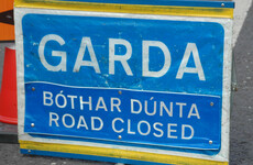
Travel disruption is likely at times caused by strong winds, poor visibility and poor surface conditions.
The Road Safety Authority is asking road users to exercise caution while using the roads over the next few days, particularly those travelling in counties impacted by the Orange Warning.
The following advice is being given to road users.
- With reporting from Adam Daly

To embed this post, copy the code below on your site


have your say