Sign in. It’s quick, free and it’s up to you.
An account is an optional way to support the work we do. Find out more.
Sign in. It’s quick, free and it’s up to you.
An account is an optional way to support the work we do. Find out more.
LAST UPDATE | 1 hr ago
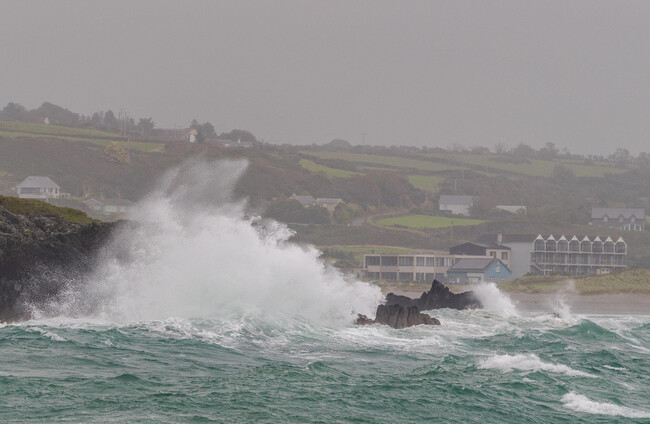
STATUS ORANGE RAIN and wind warnings have been issued for seven counties as the country braces for the arrival of Storm Boelo over the bank holiday weekend.
Met Éireann said the storm is set to track to the northwest of the country, bringing very strong winds to the north and west as well as intense spells of rain for the west and southwest.
An Orange rain warning for Galway and Kerry will come into effect from 7am until 2pm on Saturday.
The national forecaster said flooding is expected, with damage to homes and businesses, disruption and delays to public transport and very difficult travelling conditions also possible.
An Orange wind warning for Donegal, Galway, Leitrim, Mayo and Sligo will be in place from 2pm on Saturday until 9am on Sunday.
Gale-force westerly winds “with severe and damaging gusts” are expected there, according to Met Éireann. This could lead to damage to already weakened structures and power outages, as well as fallen trees, large coastal waves, coastal flooding and very difficult travelling conditions and dangerous conditions at sea.
A Status Yellow rain warning has been issued for counties Clare, Cork, Donegal, Galway, Kerry, Leitrim, Limerick, Mayo and Sligo from 4am until 3pm on Saturday.
A separate Yellow wind warning will be in place for Connacht, Clare, Kerry and Limerick from 1pm on Saturday until 12pm Sunday.
Donegal will come under a Yellow wind warning from 1pm on Saturday until 3pm on Sunday, while counties Cavan and Monaghan will be under a Yellow wind warning from 6pm on Saturday to 12pm on Sunday.
The Road Safety Authority (RSA) has urged users in areas affected by Orange warnings to check local traffic and weather conditions before setting out on a journey, while Dublin City Council has warned that high tides, combined with heavy rain and strong winds, have the potential to result in coastal flooding in some areas on Monday.
⚠️Weather warnings issued for Sat Oct 24th into Sun 25th⚠️ A combination of wind & rain warnings will come into effect for S, W & NW counties from the early hours of tomorrow (Saturday) morning, due to conditions associated with #StormBoelo More here👇 https://t.co/daaKPKzpEv https://t.co/uadRZSNWsK
— Met Éireann (@MetEireann) October 23, 2026
In the North, an Amber wind warning for counties Antrim and Derry will come into effect from 9pm on Saturday to 9pm on Sunday, while a Yellow wind warning for all of Northern Ireland will be in place from 6pm on Saturday to 3pm on Sunday.
A high tide advisory has been issued for Galway, Mayo, Sligo, Leitrim and Donegal from 3pm Saturday until 7am Sunday, with strong onshore winds associated with Storm Boelo, combined with high tides, storm surge, and large waves, potentially resulting in coastal flooding and wave overtopping.
The heavy rain from Storm Boelo will fall on saturated ground, with surface water and river flooding likely in the west and southwest. Small upland and urban rivers will respond fastest, and larger rivers may keep rising after rain eases into the weekend.
The National Directorate for Fire and Emergency Management (NDFEM), which met earlier today, said local authorities continue to have their severe weather assessment teams activated following Storm Austen.
The head of the NDFEM, Keith Leonard, said local severe weather assessment teams are through the weekend to mitigate and manage the impacts to come.
“Of particular concern is the challenge expected from extremely strong winds in the northwest. I would advise everyone to avoid coastal areas during the period of the weather warnings and heed all coastguard advice,” he said.
“We will also be closely monitoring tidal and river levels throughout the country for flooding dangers and are prepared to act promptly and effectively.”
The NDFEM is advising people to secure any loose outdoor items such as bins, garden furniture and trampolines, and to stay informed through Met Éireann and local authority channels.
It warned people to stay away from fallen cables and report such cases immediately to the ESB, and to never attempt to drive, walk or cycle through flooded roads.
The RSA said if drivers have to use the roads, they should slow down and allow a greater braking distance between themselves and the vehicle in front and to take special care when driving behind goods vehicles, as they generate a considerable amount of spray.
After going through water, drivers should proceed slowly with their foot on the brake pedal for a short distance to help to dry the brakes, to drive with dipped headlights at all times and to beware of objects being blown out onto the road and fallen debris.
Pedestrians have been advised to walk on the right-hand side of the road facing traffic.
Cyclists should ensure that they and their bike are visible to other road users by using front and rear lights and by wearing high-visibility clothes that help them to be seen on their bike.

To embed this post, copy the code below on your site












have your say