Sign in. It’s quick, free and it’s up to you.
An account is an optional way to support the work we do. Find out more.
Sign in. It’s quick, free and it’s up to you.
An account is an optional way to support the work we do. Find out more.
DENSE SMOKE BILLOWING from dozens of deadly wildfires across Canada is having an impact on the atmosphere as far as Ireland, according to weather experts.
The EU’s Copernicus Atmosphere Montoring Service (CAMS) warned this week that several wildfires have been active in the Canadian provinces of Saskatchewan, Manitoba and Ontario since May, resulting in the reported development of “pyrocumulonimbus clouds” (pyroCb).
The Canadian wildfires have been devastating, with several measuring between 100,000 and 300,000 hectares apiece, causing evacuations and the destruction of forests and homes.
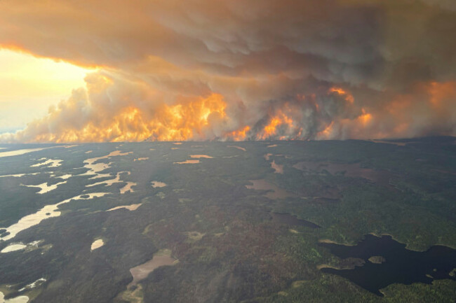
While wildfires in Saskatchewan typically begin to flare up in April and May, the situation in the province this year was exacerbated by moderate drought and strong winds in mid-May, CAMS warned.
A similar situation was observed on the border between the provinces of Ontario and Manitoba, with wildfire conditions driven by hot, dry, and windy conditions in the area.
More smoky skies are expected as this week begins, with some of the more gigantic blazes delivering thick smoke that is spreading eastward towards Europe.
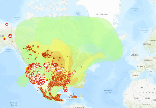
Smoke first traveled across the Mediterranean on 18 May, with sightings reported in Greece and areas around the eastern Mediterranean.
A second, more extensive plume crossed the Atlantic during the final week of May, reaching parts of northwestern Europe – including Ireland – on Sunday.
Further smoke plumes are anticipated to arrive in Europe in the coming days.
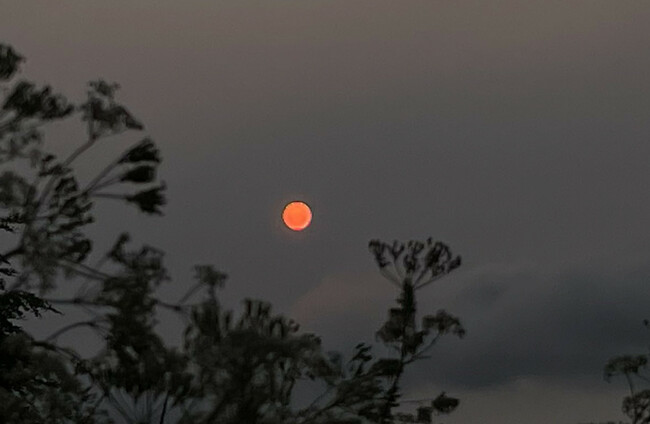
As a result, in recent days, the sun has appeared to display extra vibrant colours in Ireland, making for breathtaking sunsets across Ireland. Why is that?
It’s a scientifically jargon-y answer that has to do with how sunlight interacts with the atmosphere – when there’s smoke in the air, tiny particles scatter sunlight.
Around 6am and the sun is an incredible red which my phone camera can’t really show.
— Zwartbles Ireland • Suzanna Crampton (@ZwartblesIE) May 31, 2025
It could be swirls of sands from Africa or something that @CarlowWeather might know why.
Red sky in morning, shepherds take warning. pic.twitter.com/kwL9k4CBDR
As explained by science reporter Kenneth Chang, blue and green wavelengths scatter more easily and get redirected away from your eyes, while red and orange wavelengths pass through more directly.
The thicker the smoke, the more blue light gets scattered or blocked – leaving the sun looking red or orange, especially near the horison.
The higher-energy colours with shorter wavelengths – that is, blue light – scatter more readily, and as a result, the entire sky is suffused in blue.
Wildfire smoke back over us again this morning as this is the view of the sun rising in the sky. The main band of rain has cleared with sunny spells but also scattered showers. pic.twitter.com/ieQ0fm1lfz
— Carlow Weather (@CarlowWeather) June 3, 2025
Smoke particles also scatter light, and because they are larger than air molecules, they also scatter the orange and red colours.
That results in far more red and orange in the sky than we are used to seeing during the daytime, imparting a surreal hue.
“Up to the beginning of June, our data is showing that central regions of Canada have experienced a very intense few weeks in terms of wildfire emissions,” CAMS Senior Scientist Mark Parrington said.
“This data, and the fact that we are able to observe the smoke in Europe, is a reflection of the scale of the fires and impacts they have been having.”
PyroCb clouds, the clouds formed by the Canadian wildfires, typically form when a fire burns with exceptional heat and intensity, generating enough thermal energy to push smoke, ash and moisture high into the atmosphere from where powerful jet streams can transport the smoke over long distances.
PyroCb smoke clouds are denser than regular clouds, CAMS says – meaning more light is scattered.
Parrington said that the long-range transport of smoke caused by the fires “is not unusual”, but he added :”it is a clear reflection of the intensity of the fires that such high values of aerosol optical depth and other pollutants associated with the plume are so high as it reaches this side of the Atlantic”.

To embed this post, copy the code below on your site
















have your say