Sign in. It’s quick, free and it’s up to you.
An account is an optional way to support the work we do. Find out more.
Sign in. It’s quick, free and it’s up to you.
An account is an optional way to support the work we do. Find out more.
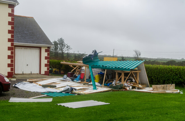
RED ALERT, FOLKS – Ireland is bracing itself for one of its most severe storms ever, as Éowyn approaches from the Atlantic.
The Status Red warnings for the entire island – starting in the wee small hours and continuing between mid-morning and noon – means there’s a likely risk of danger to life.
The forecast is for damaging and destructive gale-force winds.
Advice has been issued on how to prepare. Above all, the public is being urged to take action.
Status Red alerts from both Met Éireann and the UK Met Office mean we should take action to protect ourselves and others, as well as our property.
Teresa Mannion said it best in 2015 – don’t take risks on treacherous roads.
The National Emergency Coordination Committee (NECG) has told the public that the red weather warning means “shelter in place”: stay indoors and avoid unnecessary travel.
Employers have been told to facilitate working from home for all employees who can do so. The NECG says only emergency service workers should be leaving home for work, where directed by their employer. Schools, colleges and creches are closed.
Roads will be dangerous, the Road Safety Authority (RSA) has warned. The extremely strong winds will result in fallen trees and power lines, destruction to flying debris, and road blockages.
Gardaí have appealed to the public not to put themselves or members of the emergency services at risk.
Gardaí have also urged the public to remain vigilant even after the worst of the storm has passed. Over the coming weekend, anyone using the roads should “slow down, expect the unexpected and stay safe”.
Keith Leonard, chair of the NECG, has also warned today that “even after the warnings expire” – likely to be between 10am and 12 noon tomorrow for the red alerts – the public should be making “only essential travel, even at that stage” and expect “extremely disruptive conditions”.
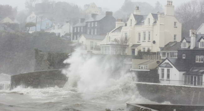
Coastal areas are likely to be particularly unsafe.
Hurricane-force winds are forecast up the west coast and inhabitants of islands, in particular, have been urged to take great care.
Met Éireann’s advice for coasts is to “stay back, stay high, stay dry”. It warns of the potential for wave over-topping and coastal flooding in low-lying, exposed Atlantic coastal areas.
The RSA has a particular word of warning for any storm enthusiasts considering a little stroll down the Salthill prom for a selfie.
“Coastal areas face dangerous storm surges and flooding, and under no circumstances should people put themselves at risk by engaging in storm voyeurism,” the RSA said.
We’ve all seen the videos of trampolines rolling onto roads, into other people’s gardens and even onto rooftops during storms – don’t let your trampoline be the next viral victim.
Oh no, oh no, oh no no no! The trampoline that nearly broke free (and almost took it's owners on a magic carpet ride!) Video from one of our followers in Bantry this morning 🙈 pic.twitter.com/fUoNYDsJyu
— Cork Safety Alerts (@CorkSafetyAlert) December 7, 2021
While the weather still remains calm it is very important to secure or pack away garden furniture and anything else loose on your property that could blow away, to ensure safety for yourself, your neighbours and your property.
Wheelie bins should also be secured.
If objects are too big to be placed indoors they should be secured or weighed down.
Strong winds are likely to cause significant and widespread power outages tomorrow. This was among the headline warnings from the NECG in their briefing to the media today.
If you have a power bank, charge it up now before the storm hits – it’s a great way to be prepared if your electricity goes.
Charging devices such as phones and laptops ahead of time is also a good idea.
You should also make sure you have batteries for torches or appliances you might need if you find yourself without power.
Having candles and matches on hand may also be useful – the storm will hit overnight and power could cut while it’s still dark out.
ESB Networks said in a statement to The Journal that their crews and partner contractors around the country have been preparing, with all available resources on alert.
The ESB advise having your Meter Point Reference Number noted during stormy weather, and your Eircode is another set of digits to keep handy in case you need to report anything.
Some emergency numbers are:
Keith Leonard, chair of the NECG, urged the public today to “check that vulnerable and older people have everything that they need in advance of Storm Éowyn setting in”.
You could ask your neighbours if they need anything from the local shop or chemist, and check if they need any help securing their garden or home.
It may help to share your mobile number for them to call if they have any problems.
It’s important to know the weather forecast in your area and act accordingly.
Met Éireann offers an app with customisable alerts on both iOS and Android, in addition to their website and regular appearances in the media. The UK Met Office has an app too.
We’ll be covering all the latest news here on The Journal. If you’d like to share an update on how the storm affects your area, email us on tips@thejournal.ie.
Red warnings for #StormÉowyn have been updated as follows.
— Met Éireann (@MetEireann) January 23, 2025
These changes are because the latest forecast shows the system clearing out slightly earlier than forecasted yesterday. pic.twitter.com/AistGVDQsi
With reporting by Valerie Flynn.

To embed this post, copy the code below on your site














have your say