Sign in. It’s quick, free and it’s up to you.
An account is an optional way to support the work we do. Find out more.
Sign in. It’s quick, free and it’s up to you.
An account is an optional way to support the work we do. Find out more.
LAST UPDATE | 6 Dec 2024
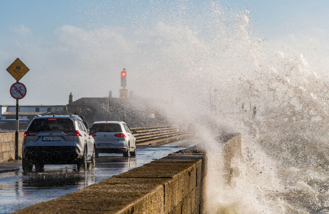
THE PUBLIC HAS been advised not to travel and to shelter in place in areas where a Status Red wind warning is in place.
Warnings are now in place in Mayo, Clare and Galway, with Met Éireann forecasting extremely strong gusts.
Another Red wind warning will be in place for Donegal, Sligo and Leitrim from 11pm.
The warning for Mayo is set to last until 3am while the Clare and Galway warning will be in place until 2am. The Donegal and Leitrim warning will expire at 3am.
Another Red wind warning has been issued for Wicklow and will be in place from 1am to 6am.
A Status Orange wind warning has come into effect in the rest of the country.
There is a Yellow rain warning for Northern Ireland that came into effect at 3pm today and is to last until 6am on Sunday.
There is also a Status Yellow rain warning in place for Clare, Connacht, Donegal, Cavan, Monaghan, Longford, Louth, Meath and Westmeath until 10am tomorrow.
Bus Éireann has announced a number of service cancellations which are listed on its website.
The Department of Housing, Local Government and Heritage has said that members of the public should not travel in areas where a Red level warning is in place, and should shelter in place during the affected times.
“Essential services operators will continue to operate services, where it is safe to do so, subject to prevailing local conditions.”
The Road Safety Authority (RSA) has advised road users in areas affected by the Red warning to avoid any travel during the storm window.
The RSA is also advising all road users to take extreme care over the weekend as there may be fallen trees, damage to power lines, wave overtopping and there may be very difficult travelling conditions and damage to temporary structures.
The National Directorate for Fire & Emergency Management (NDFEM), Met Éireann and other bodies met this afternoon to discuss the weather warnings.
The head of the NDFEM, Keith Leonard, has advised people in areas affected by the Red warnings to shelter in place and think twice about heading on a night out due to the hazardous conditions being forecast.
“You’d want to think carefully about your plans for this evening and early tomorrow in terms of travel, and certainly event organisers,” Leonard told RTÉ Radio.
He also urged people to secure things like garden furniture and trampolines and warned people who are working alone tomorrow, cleaning up after the storm, to be very careful and not to climb ladders on their own.
Rain will spread across the country from the west and will be heavy at times, possibly causing localised flooding, said Met Éireann.
The Department of Social Protection has said that the Humanitarian Assistance Scheme will be available to support people whose homes are affected by the storm.
Status Red ⚠️
— Met Éireann (@MetEireann) December 6, 2024
Wind warning for Mayo
Valid: 22:00 Fri 06/12 to 03:00 Sat 07/12
Wind warning for Clare, Galway
Valid: 22:00 Fri 06/12 to 02:00 Sat 07/12
Wind warning for Donegal, Leitrim, Sligo
Valid: 23:00 Fri 06/12 to 03:00 Sat 07/12https://t.co/dz6JbE5FIb#StormDarragh pic.twitter.com/g0vHbrg9zo
Some sleet is possible on northern hills and there is a chance of isolated thunderstorms.
Strong and gusty winds will develop through the morning and will become very strong and gusty in the afternoon and evening, the forecaster said.
Tonight, winds will turn northwesterly and will become “very strong, with some severe and damaging gusts, reaching storm force at times near coasts”, Met Éireann said.
The rain will gradually clear eastwards through the night and will be followed by frequent showers, the forecaster said.
Some sleet is possible in the north and lowest temperatures will be between 1 and 5 degrees.
Met Éireann has issued three Status Red Wind Warnings for Clare, Donegal, Galway, Mayo, Leitrim & Sligo from approx. 10pm tonight until 3am tomorrow due to the arrival of #StormDarragh.
— Bus Éireann (@Buseireann) December 6, 2024
Information on services affected is available online from https://t.co/GB681Pnfzf#StatusRed pic.twitter.com/gfZwDO9LA2
Cork County Council met this morning and is advising people to prepare for the arrival of the storm, including by taking preventative measures to protect and safeguard their property as well as ensuring their mobile phone is fully charged.
The Council has also advised people to stay away from coastal areas during this period with the Irish Coast Guard appealing to people to “Stay Back, Stay High, Stay Dry”.
Dursey Cable Car is closed to the public today and tomorrow and is expected to reopen on Sunday, subject to an inspection if necessary. Islanders will be accommodated as weather warnings and local wind speeds allow, the Council said.
ESB Networks is highlighting the dangers posed by fallen live wires and is advising the public to stay away from fallen cables, to treat all fallen cables as live, and to report such cases immediately to 1800 372 999. The public can monitor www.PowerCheck.ie for updates about power restoration times.
The Simon Community has warned that tonight will be particularly difficult for people sleeping rough.
Catherine Kenny, CEO of the Dublin Simon Community told RTÉ Radio that conditions tonight will be “very grim for people who are expected to sleep outside tonight”.
“It’s dire with regards to the potential harm to their health,” she said.
“What we’re doing is we’re working throughout the city and across the regions to make sure that as many people as we can possibly get into accommodation are facilitated to do so. We’re making sure that people have hot beverages.”
She said that there is extra space available to accommodate people and asked people to contact the Simon Community and inform them if they come across people sleeping on the street.
She said she hopes that homeless asylum seekers are offered emergency accommodation but added that the Simon Community had not been “formally notified” as to whether this would be happening today.
Uisce Éireann is putting measures in place to minimise the impact of the storm on water supplies.
Due to the severity of the storm, it said it’s it is likely that there will be some disruption to water and wastewater services in certain locations, particularly if electricity supply is affected.
“Uisce Éireann has activated its emergency response processes, including deploying generators at key sites where power outages are likely,” it said in a statement.
“Should there be any impact on water supply, Uisce Éireann will have crews on the ground throughout the weekend to restore supply as quickly as possible.”
In the event of a loss of supply, it says most properties should have adequate storage in their attic tanks for hygiene purposes for at least 24 hours. Other tips on ways to conserve water can be found at water.ie/conserve.
Customers can get updates about their local water supply on water.ie, via Uisce Éireann’s X feed @IWCare, or by signing up for its free text alert service on the website.

To embed this post, copy the code below on your site














have your say