Sign in. It’s quick, free and it’s up to you.
An account is an optional way to support the work we do. Find out more.
Sign in. It’s quick, free and it’s up to you.
An account is an optional way to support the work we do. Find out more.
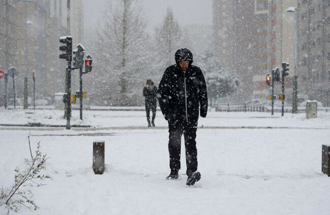
STORM GORETTI IS set to bring heavy snow, strong winds and disruption to parts of Britain and northern France later this week, but Met Éireann says Ireland is likely to escape the worst of the system.
Met Éireann meteorologist Linda Hughes said current forecast models show the storm tracking to the south of Ireland.
“At the moment, forecast models have the storm passing to the south of Ireland, so it’s really going to impact southern parts of the UK and France,” Hughes told The Journal.
“It will bring unsettled weather here on Thursday, mainly rain in southern areas, but at the moment it’s not looking like it will bring anything significant to Ireland.”
🌀 Storm Goretti, named by Meteo France, is set to become the first named storm of the year, impacting parts of the UK with gales, heavy rain, and snow.
— Weather & Radar UK/Ireland (@WeatherRadar_UK) January 6, 2026
Keep track on the radar: https://t.co/hUgtyXVTr5 #Weather #Storm #UKWeather pic.twitter.com/SbwNI5HQhr
Storm Goretti, named by Météo-France, is expected to move eastwards on Thursday, bringing heavy snow and gale-force winds to southern England, south Wales and northern France.
As a result of the storm, the UK Health Security Agency (UKHSA) has extended its amber cold health alerts across England until midday on Sunday.
The strongest winds are forecast to remain on the southern side of the system, meaning it would need to track much further north to have a major impact on Ireland.
Hughes said there is still a small chance the system could shift slightly north, which could bring stronger winds to parts of the south coast, and possibly some disruption to ferry services.
“We could see some gale-force winds along the south-east coast depending on the exact track, and there is a possibility of some ferry disruption, but it doesn’t look like it will affect the Irish Sea at the moment,” she said.
The storm comes after several days of exceptionally severe cold weather across Europe.
Temperatures have plunged as low as -12.5°C in parts of England and below -10°C in the Netherlands, where rail services were brought to a standstill.
At least six people have died in weather-related incidents across France and the Balkans during what has been described as the bitterest cold snap of the winter so far.
☀❄ Avec le retour du #soleil, l'image du satellite dévoile une large moitié nord de la #France enneigée... Les cumuls de #neige plus importants se distinguent parfaitement sur la #CharenteMaritime qui a vécu un épisode historique, la couche dépassant localement les 30 cm ! pic.twitter.com/caHFFyBPYc
— Guillaume Woznica (@GWoznica) January 6, 2026
Hundreds of flights were cancelled at major airports including Paris Charles de Gaulle and Amsterdam Schiphol, while heavy snowfall closed schools across Scotland and left parts of eastern Europe dealing with flooding, power outages and impassable roads.
In Ireland, the worst of the cold snap is now easing, but wintry conditions are set to linger.
“The coldest weather really is past us now,” Hughes said, “but it’s still going to stay fairly wintry over the next few nights.”
She said temperatures will continue to drop below freezing in places, with frost, icy patches and the possibility of isolated wintry showers, particularly in the northwest.
Hughes added that the path of Storm Goretti will continue to be closely monitored.

To embed this post, copy the code below on your site












have your say