Sign in. It’s quick, free and it’s up to you.
An account is an optional way to support the work we do. Find out more.
Sign in. It’s quick, free and it’s up to you.
An account is an optional way to support the work we do. Find out more.
LAST UPDATE | 26 Jun
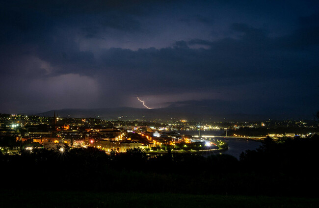
A STATUS ORANGE thunderstorm warning has been issued for Galway, Mayo and Roscommon, while higher temperatures are to continue into Saturday.
The latest warning issued by Met Éireann has already come into effect and will be in place until 8pm tonight.
Until 10pm, all of Connacht and counties Cavan, Donegal, Monaghan and Longford are under a further Status Yellow thunderstorm warning.
The storms may cause localised flooding, hail damage, difficult travelling conditions, damage to utilities including power and water, and very gusty winds.
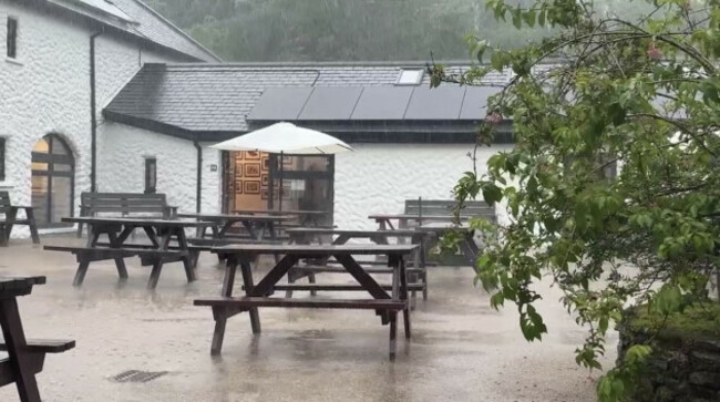
Temperatures reached highs of 27 degrees so far today, and a nationwide high temperature warning has been extended until Saturday morning.
Meanwhile, a similar thunderstorm warning has been issued across Northern Ireland by the UK Met Office, which has been in place since 12am and lasts until 10pm.
Elsewhere, a nationwide Status Yellow high temperature warning issued by Met Éireann earlier this week will now remain in place until Saturday morning.
Temperatures of 27 degrees have already been recorded today, with Oak Park in Co Carlow reaching this figure at 1pm.
The national forecaster has warned there is a risk of forest fires, water safety issues, heat stress and uncomfortable sleeping conditions.
That means parts of Ireland are officially in a heatwave.
A heatwave in Ireland occurs when five or more consecutive days of 25 degrees or more are observed at a Met Éireann station.
Met Éireann says that when a heatwave occurs, the average duration is six days long.
The current spell of hot weather is being driven by a plume of very warm air moving north from Europe, where several countries have experienced extreme heat in recent days.
Heatwaves are becoming more frequent, longer-lasting and more intense as a result of climate change.
In the UK, a new record high temperature has been set for June for the third day in a row.
A provisional temperature of 36.9 degrees recorded in Wattisham, Suffolk today, as rare red weather warnings remain in place.
There are over 500 schools either fully or partially closed because of the heat.
France saw a fourfold increase in emergency room visits for heat-related reasons and a surge of cardiac arrests, the health ministry said.
“We are reaching a saturation point in hospital facilities,” Paris police chief Patrice Faure said, announcing a rare ban on evening alcohol sales in Paris over the weekend.
Paris also postponed its Pride parade, scheduled for Saturday afternoon.
Some cooler air breezed over western parts, but central and eastern Europe warned their heatwaves had yet to peak. The Czech Republic and Hungary were on red alert for the weekend, with temperatures of up to 40 degrees forecast.
Meanwhile in Ireland, the National Severe Weather and Flooding Coordination Group met this morning to assess the forecasted weather for the coming days.
As of 5.15m, ESB networks reported there were still around 6,500 customers without power as a result of lightning strikes, with crews on the ground working to resolve those issues.
https://x.com/CarlowWeather/status/2070539682908172374
It warned that further thunderstorms may impact additional customers, and the public is reminded to stay away from any fallen cables or damaged electricity equipment and to report such cases to the ESB immediately.
Following the meeting, the group also reminded the public to continue to follow the advice which has been issued over the past few days.
The main public advice if thunderstorms develop is to move indoors immediately if you hear thunder and to avoid driving unless necessary if heavy rain begins.
The public should also never drive, walk or cycle through floodwater and should lightning develop, stop any outdoor sports and seek shelter.
The public has also been advised to avoid partaking in strenuous activities during the hottest part of the day and apply sunscreen.
A reminder has also been issued that high temperatures can be a “real strain for elderly people” and that elderly people living alone should be checked in on.
Today has been another warm and humid day, with a mix of sunshine and scattered showers. The showers will be heavy and thundery at times in the midlands, west and northwest, with the possibility of localised flooding and lightning.
The showers will die out tonight and clear spells will develop before becoming cloudier with patchy rain and drizzle.
Nighttime conditions are expected to remain very mild and humid, with temperatures generally staying above 15°C.
Saturday will be overcast early on with scattered showers, which may be heavy for a time. It will be cooler than previous days with highest temperatures of 19 to 23 degrees.
Unsure of what exactly is happening with the earth’s climate? Check out our FactCheck Knowledge Bank for essential reads and guides to finding good information online.

To embed this post, copy the code below on your site













have your say