Sign in. It’s quick, free and it’s up to you.
An account is an optional way to support the work we do. Find out more.
Sign in. It’s quick, free and it’s up to you.
An account is an optional way to support the work we do. Find out more.
TEMPERATURES ARE EXPECTED to reach as high as 21 degrees Celsius today before the weather takes a wetter turn in some parts of the country from tomorrow with outbreaks of rain, according to Met Éireann.
The national forecaster says that today’s weather will be “very mild” with highest temperatures of 16 to 21 degrees in mostly light southerly or variable breezes.
There could be some isolated light showers affecting west and northwest counties.
Tonight will be dry under broken cloud for most areas tonight, with some isolated light showers potentially affecting northwest areas early on. Some areas of mist and shallow fog are expected to develop too.
Temperatures will dip to lows of 3 to 7 degrees.
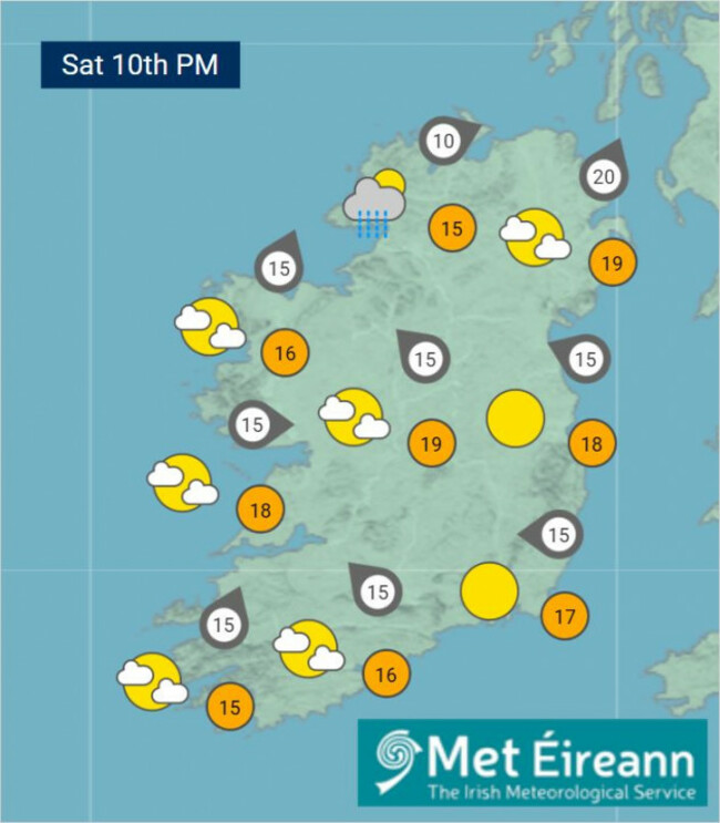
Tomorrow is expected to start off mostly dry with a mix of cloud and hazy sunny spells.
However, cloudy conditions with patchy rain and drizzle will affect parts of west Connacht and west Ulster.
It’ll become mostly cloudy as the day goes on, Met Éireann says, with outbreaks of rain spreading from the southeast.
Highest temperatures tomorrow will be around 15 to 20 degrees but a little cooler near Atlantic coasts.
On Monday, there’s expected to be a mix of cloud and sunny spells with showers merging to longer spells of rain at times.
Some heavy or thundery falls are possible on Monday, followed by a mix of sunny spells and rain showers with isolated thunderstorms on Tuesday.

To embed this post, copy the code below on your site












have your say