Sign in. It’s quick, free and it’s up to you.
An account is an optional way to support the work we do. Find out more.
Sign in. It’s quick, free and it’s up to you.
An account is an optional way to support the work we do. Find out more.
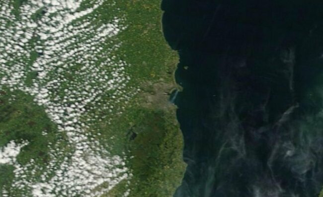
THERE WERE SEVERAL impressive photographs of last week’s gorse fire in Howth Co. Dublin but perhaps none quite so impressive as this one from NASA’s Terra satellite.
The fires burned over the course of a couple of days on the North Dublin peninsula before being brought under control by fire fighters.
They blazed long enough for this striking snap to be taken by Terra though which clearly shows the fires burning on Howth with a plume of smoking blowing southwards over Dublin bay.
(Source: NASA Imagery)
Terra satellite is a multi-national NASA satellite that orbits the earth taking pictures from scientists to research the planet’s atmosphere, lands, and oceans.
You can view the full zoomable photo of Ireland and the UK showing the Howth fiire here.
Hat tip to the James Joyce Museum for bringing the pic to our attention.

To embed this post, copy the code below on your site













have your say