We need your help now

Support from readers like you keeps The Journal open.

You are visiting us because we have something you value. Independent, unbiased news that tells the truth. Advertising revenue goes some way to support our mission, but this year it has not been enough.

If you've seen value in our reporting, please contribute what you can, so we can continue to produce accurate and meaningful journalism. For everyone who needs it.

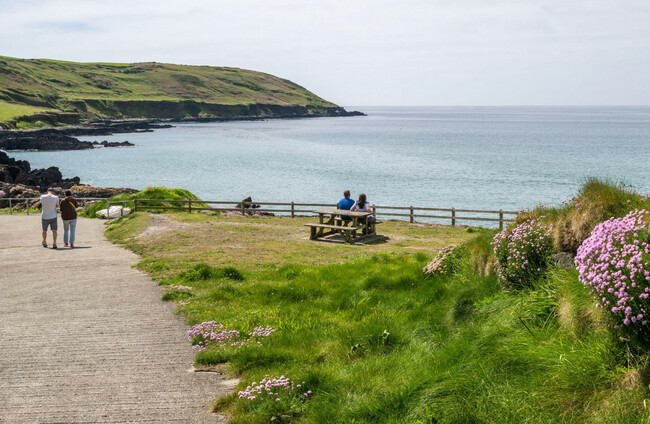
Dunworley Beach in West Cork. Alamy Stock Photo

Temperatures could hit 31C in parts today as heat warning remains in place for eight counties

Met Éireann said temperatures will drop towards the end of the week, with rain expected this weekend.

TEMPERATURES COULD REACH 31C in some parts of the country today, but there is unsettled weather on the way. 

The forecaster said it will be very warm or hot today, with the highest temperatures set for the midwest and west. 

A Status Yellow high temperature warning remains in place for counties Clare, Kerry, Limerick, Tipperary, Galway, Kilkenny, Laois and Offaly until 6pm.

Maximum temperatures in these counties are expected to be in excess of 27C in those counties, combined with the lowest nighttime temperatures in excess of 15C.

This could lead to water-safety issues due to increased use of lakes and beaches and the possibility of forest fires, as well as uncomfortable sleeping conditions and heat stress.

After the record high temperature for May was provisionally broken twice this week, Met Éireann has said that today will be the last day of very warm weather.

Senior forecaster Gerry Murphy told RTÉ’s Morning Ireland that people should expect a change in the next few days.

“There will still be a very warm day tomorrow in the east and northeast, but overall the air flow is changing gradually as we go through the next 24 hours,” he said.

“Our weather will once again, as normal, come more from the west as we go towards the end of the week and over the weekend, and that will mean that there will be a drop in temperatures.”

Murphy said as there is more moisture coming into the air today, some parts of the country could see heavy showers or thunderstorms developing alongside the heat. 

While many areas will escape these, where they do hit, they could be severe with lightning and hail. 

Met Éireann is forecasting top temperatures of 22 to 31C, hottest in the midwest and west, though a little lower for some east and northeast coasts due to a mostly moderate easterly breeze. 

Tonight will be largely dry and mild, though some cloudy and drizzle will develop across the southwestern half of the country by morning. Temperatures won’t fall below 11 to 16C.

Thursday will see sunny spells in the north and east, but cloud will build from the southwest and bring patchy light rain and drizzle. There will still be a lot of dry weather and limited sunny spells, with highs of 17 to 23C.

On Friday, any lingering patchy rain in the north and west will clear by the morning, with the rest of the day to remain largely dry with plenty of sunshine and some isolated showers. Temperatures will reach highs of 17 to 22 or 23C.

Murphy said rain will move in on Saturday and there will be a few showers on Sunday, with more rain expected on Bank Holiday Monday.

After today, back to what we’d see as a typical mix of Irish weather and not as warm.

Changing climate

He said that while it’s not unusual to have “a decent spell of weather” in May, what is unusual is that “it has become so hot so early in the summer”.

“It turns out that with the climate change occurring, what we call the return period – the likelihood of more increased intense heat events – has been increasing, and is forecast to increase, which means that the possibility of weather events like this are more likely as we go forward,” he said.

“This is typically one of them, and it is quite a significant one, because the maximum temperature has been broken by more than two degrees.”

Shifting weather patterns around the world and successive record-breaking conditions are evidence of climate change, which is being caused by human activities leading to excessive greenhouse gas emissions that trap heat inside the atmosphere.

Many people will have enjoyed the unusually warm conditions this early in the year – but it’s also a concerning signal of the climate change the world faces, which is on track to escalate in coming years if countries fail to reduce their greenhouse gas emissions.

New projections published today by the Environmental Protection Agency show that Ireland is on course to deliver only half the reductions of greenhouse gas emissions required by 2030.

Water safety

With the warm weather continuing, the RNLI is urging people to be water safe. 

Linda-Gene Byrne, the RNLI’s regional water safety lead, told RTÉ’s Morning Ireland that although the weather is sunny, the water is still very cold because it hasn’t had enough time to heat up.

“While we might be very, very hot today, when we hit that water, there’s a very good chance of cold water shock hitting us if we hit the water too quickly,” she said. 

Anything below 15C is defined as cold water and can seriously affect breathing and movement.

“What happens is you get that involuntary gasping panic and a loss of breathing control as your body gets a sudden shock of that cold water hitting it,” Byrne said, adding that it is important for people to try and acclimatise slowly when going into water. 

Anyone who experiences cold water shock should float to live, she said.

The best way for someone to float is to go on their back in the water, tilt their head back with their ears submerged and try to relax and breathe normally. “In 60 to 90 seconds, you should be able to get your breathing back under control,” Byrne said.

She said people can gently move their hands and legs to help stay afloat if you need to. “It’s okay if your legs sink a little bit. Everyone floats a little bit different, but everybody is able to float.” She said once their breathing is under control, they can call for help or swim to safety. 

Byrne also said that if someone else is in difficulty, the main thing to do “is not to get in yourself”.

“The first thing that you should do is phone 999 or 112 for the emergency services. Ask for the Coast Guard, and immediately the operator will dispatch any emergency assets that are needed,” she said.

“The emergency response units would much prefer to get the call and be on the way, and if everything resolves itself and they’re not needed, they’re happy to stand down, but have those emergency services on the way.”

She said people should also shout out to the person in difficulty to stay calm and give them instructions on how to float and get their breathing under control. They should also look for any rescue equipment like a buoyancy aid, throw bag or a long pole to throw to the person while staying safe themselves. 

Readers like you are keeping these stories free for everyone...
A mix of advertising and supporting contributions helps keep paywalls away from valuable information like this article. Over 5,000 readers like you have already stepped up and support us with a monthly payment or a once-off donation.

Close
15 Comments
This is YOUR comments community. Stay civil, stay constructive, stay on topic. Please familiarise yourself with our comments policy here before taking part.
Leave a Comment
    Submit a report
    Please help us understand how this comment violates our community guidelines.
    Thank you for the feedback
    Your feedback has been sent to our team for review.

    Leave a commentcancel

     
    JournalTv
    News in 60 seconds