Sign in. It’s quick, free and it’s up to you.
An account is an optional way to support the work we do. Find out more.
Sign in. It’s quick, free and it’s up to you.
An account is an optional way to support the work we do. Find out more.

LAST UPDATE | 9 hrs ago
CONDITIONS HAVE STARTED to ease this morning as Storm Austen dissipates, but forecasters are already anticipating the impacts of a second storm due to hit on Saturday.
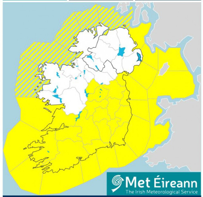
Storm Boelo will bring Status Orange-level weather conditions to six counties tomorrow, with a broader Status Yellow warning to take effect in nine counties.
Kerry will have an Orange-level rain warning in place from 7am to 2pm on Saturday, while Donegal, Leitrim, Galway, Mayo and Sligo will be under an Orange wind warning from 2pm Saturday to 9am Sunday morning.
Clare, Cork, Donegal, Galway, Kerry, Leitrim, Limerick, Mayo and Sligo will be subject to a Status Yellow warning for rain on Saturday from 4am to 3pm.
The first storm of the season, Storm Austen, hit the country overnight.
Across Leinster and Munster, a Status Yellow warning for rain and wind came into effect at 7pm on Thursday night and will stay in place until 10am this morning.
Previously, two Status Orange rain warnings were in place that have since expired: Dublin, Wexford and Wicklow until 8am and Cork, Kerry and Waterford until 5am.
County council crews have been dealing with the impacts of localised flooding in some places.
Road users have been advised to leave extra time for journeys in case of delays and watch out for fallen trees and debris, especially during peak commuting hours.
10.30am: Galway has been added to the list of counties covered by the Status Orange wind warning between 2pm Saturday and 9am Sunday.
9.45am: And in Donegal, Leitrim, Mayo, Sligo during the Status Orange wind warning, there could be:
9.40am: What will those warnings mean for the areas affected?
In Kerry, during the Status Orange rain warning, Met Éireann is urging the public to prepare for potential:
9.25am: Met Éireann has now announced that five counties will also be under Status Orange weather warnings at times on Saturday and into Sunday morning.
Kerry will have an Orange-level rain warning in place from 7am to 2pm, while Donegal, Leitrim, Mayo and Sligo will be under an Orange wind warning from 2pm Saturday to 9am Sunday morning.
9.10am: Met Éireann has issued a new Status Yellow warning for rain. This one is for Storm Boelo, the second storm of the season that is swiftly following Storm Austen.
Clare, Cork, Donegal, Galway, Kerry, Leitrim, Limerick, Mayo and Sligo will be subject to the warning from 4am to 3pm.
9.03am: What does the forecast have in store for the rest of the day? A mix of sunshine and scattered blustery showers, particularly in western counties. Winds will be occasionally strong and gusty but ease towards the evening. Highest temperatures today will reach between eight and 12 degrees Celsius.
8.41am: Waterford County Council has noted several instances of fallen trees blocking roads and flooding.
8.20am: Irish Rail has “dodged a bullet” and isn’t experiencing any adverse effects from the storm, its corporate communications manager Barry Kenny said on Newstalk.
8.14am: A bit of good news for anyone planning to run the Dublin marathon or cheer on a loved one: Sunday should be the best day (relatively) of the weekend weather-wise, according to climate scientist Cathal Nolan speaking on Newstalk Breakfast.
8.07am: At Dublin Airport, it’s a wet morning, but flights are operating as normal and aren’t experiencing any unusual delays.
8am: A Status Orange rain warning that was in place in Dublin, Wexford and Wicklow has now expired. A Status Yellow warning for rain and wind remains in effect across Leinster and Munster until 10am.
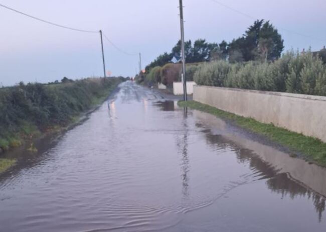
7.45am: In Cork, up to 60mm of rain was recorded in parts of the county overnight and there have been reports of more than 40 fallen trees and branches. No river flooding has been reported, but some localised ponding and surface water are a concern, Cork County Council has said, and could create hazardous driving conditions this morning.
7.42am: Bus Éireann has said that the storm may cause disruptions to its services in the east and southeast, and is asking customers to allow extra time for their journeys.
7.35am: As of 7am, around 3,000 homes, farms and businesses are without electricity as a result of the storm, according to ESB, which has deployed crews to affected areas to carry out restoration work where it’s safe to do so.
7.29am: The weather should pick up a little as the day goes on, though western counties can expect some blustery showers.
7.25am: And in Dublin city centre, about 30mm of rain fell across the city overnight, according to senior engineer Brian Henley speaking on Morning Ireland. That was higher out in the Dublin Mountains – around 40mm.
7.22am: In the Dublin area, Fingal County Council crews have been assessing swollen streams and some localised flooding, which is now receding, according to the council’s director of operations Sinéad Murphy speaking on RTÉ Radio 1′s Morning Ireland.
7.04am: Storm Austen is the first named storm of this storm season, but it won’t be the only one for long. A second storm, Storm Boelo, is set to quickly follow over the weekend and bring heavy rain on Saturday and Sunday.
Keith Leonard of the National Directorate for Fire and Emergency Management has said that “local response teams will be very busy throughout the bank holiday weekend”.
6.42am: Good morning from The Journal. Met Éireann has warned that heavy rains brought in by the storm could cause localised flooding and difficult travelling conditions this morning. There could be fallen trees and branches, as well as debris and loose objects becoming displaced.
In Dublin, Wexford and Wicklow, which are under the Status Orange warning until 8am, Met Éireann is cautioning that travel conditions could be very difficult and that disruption and delays to public transport is likely.

To embed this post, copy the code below on your site











have your say