Sign in. It’s quick, free and it’s up to you.
An account is an optional way to support the work we do. Find out more.
Sign in. It’s quick, free and it’s up to you.
An account is an optional way to support the work we do. Find out more.
YOU MIGHT HAVE had a slightly chillier time of it than you’d expected if you were lucky enough to be able to venture on a sneaky trip to the beach this afternoon.
While most parts of the country enjoyed clear skies and temperatures well up in the 20s this morning, sea fog has now crept in to many coasts.
Case in point, Dublin city this afternoon.
Photographer Paul Sherwood took this shot of the Poolbeg chimneys from Dun Laoghaire Harbour earlier…
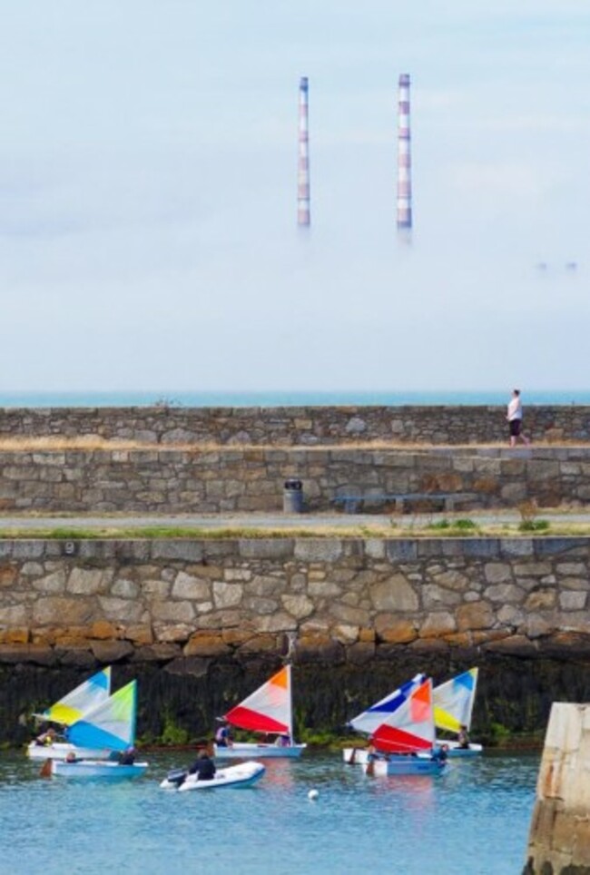
According to Met Éireann, similar conditions are now being experienced in coastal areas around the country.
There’s also the risk of “an occasional heavy shower in the west” this evening.
However, after a showery and still pretty humid night — the fog’s set to lift and we’re in for more fine sunshine tomorrow.
According to the weather service:
“Another warm and humid day on Wednesday with more spells of sunshine. Most places will stay dry, but some thundery showers are expected, with the western half of the country most at risk.
Temperatures will reach 20 to 27 degrees in light variable winds.
The warm and humid weather is set to continue until Saturday, but there’s some indications a fresher system will then take over.
How is the weather where you are? Send your pics to pictures@thejournal.ie.

To embed this post, copy the code below on your site













have your say