Sign in. It’s quick, free and it’s up to you.
An account is an optional way to support the work we do. Find out more.
Sign in. It’s quick, free and it’s up to you.
An account is an optional way to support the work we do. Find out more.
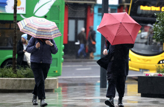
THE WEATHER IS to take a turn from tomorrow as all of Ireland will be impacted by a weather warning.
The national forecaster has warned that the weather will become rainy, cool and breezy for the next few days. Some areas may see wintry showers and lying snow.
A Status Yellow wind warning for Ireland will come into effect from 12am tonight until 6pm tomorrow.
Met Éireann has warned that strong and gusty southwesterly winds may cause difficult travelling conditions, debris or loose objects displaced and some fallen branches or trees.
Meanwhile, a Status Yellow rain warning will also be in place for all of Connacht, as well as counties Cavan, Donegal, Monaghan, Clare, Kerry, Limerick, Tipperary, Dublin, Kildare, Laois, Longford, Louth, Meath, Offaly, Westmeath and Wicklow.
Rain with heavy downpours in places may cause spot flooding, poor visibility and difficult travelling conditions. The warning comes into effect at midnight and expires at 6pm tomorrow.
In Northern Ireland, the UK Met Office has issued a yellow wind warning for counties Antrim, Armagh, Down, Fermanagh, Tyrone and Derry from 6am to 12pm tomorrow.
It warned that strong winds along with a spell of heavy rain will lead to difficult travel conditions on Thursday morning.
Tonight will start off dry in many areas, but rain will develop in the west and northwest early in the night and will spread eastwards to all areas overnight. Lowest temperatures of 5 to 9 degrees are expected.
Tomorrow will be wet and windy with spells of rain and strong winds. Rain will be heavy at times with spot flooding possible. The temperature will drop to between 4 to 8 degrees over the northern half of the country in the afternoon and 8 to 11 degrees further south.
Thursday night will be cold with scattered blustery wintry showers, mainly affecting Atlantic counties. Some of the showers will be heavy with isolated thunderstorms.
Met Éireann said some lying snow is possible across higher ground and parts of the northwest. Lowest temperatures of 0 to 4 degrees are expected.
Friday will be another cold and breezy day with sunny spells and scattered showers. The showers will fall as sleet and possibly snow at times early on. Isolated thunderstorms and hail are also likely.
Highest temperatures of 5 to 8 degrees are expected, but fresh and gusty westerly winds will bring an added wind chill.
The showers will largely stick to Atlantic coasts Friday night. Lowest temperatures of 1 to 5 degrees are expected.
Saturday will start off dry with sunny spells but become cloudy as rain and drizzle spread from the west. Highest temperatures of 5 to 9 degrees are expected.
The rain will ease during Saturday night. Lowest temperatures of 5 to 8 degrees are expected.
Sunday will be a cool and breezy day with sunny spells and blustery showers, some turning wintry in places with sleet or hail possible. Highest afternoon temperatures of 5 to 9 degrees are expected.

To embed this post, copy the code below on your site














have your say