Sign in. It’s quick, free and it’s up to you.
An account is an optional way to support the work we do. Find out more.
Sign in. It’s quick, free and it’s up to you.
An account is an optional way to support the work we do. Find out more.
Updated 1.40pm
A HARSH, WINTRY weather system is sweeping in from the west – and we can expect some pretty unpleasant conditions this weekend as a result.
A status yellow wind warning has been issued for Ireland with gusts of up to 100 km per hour expected in some areas tomorrow and Sunday.
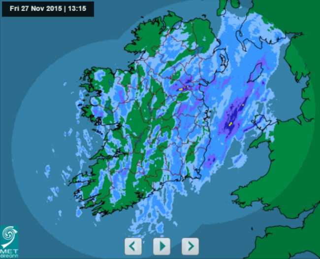
And this is what Met Éireann’s rainfall radar looks like:
Though it was relatively mild for a November morning, colder more showery weather is creeping in this afternoon.
And later we can expect:
Some hail or sleet are likely, with a little wet snow on northern hills.
It will be cold and windy tonight, with temperatures between one and five degrees. There’ll be showers, turning into longer spells of rain – with heavy wintry showers in some areas, particularly Ulster.
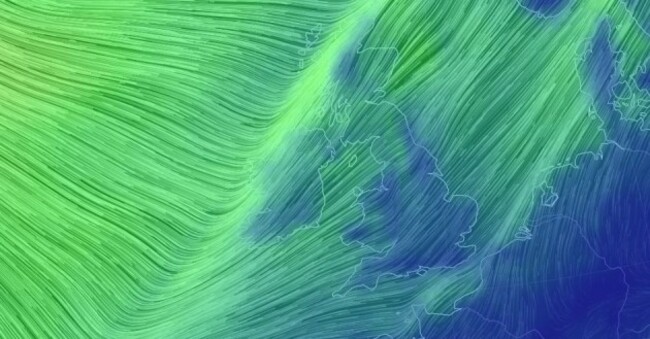
Saturday will be “windy and blustery with strong to gale force and gusty southwesterly winds, veering westerly in the afternoon and evening”. There’ll be widespread rain in the morning and early afternoon, heavy in places but turning showery later.
Sunday will be very wet, windy and blustery, “with strong to gale force and gusty southwest winds” and a risk of spot flooding.
And here’s the general outlook:
Very unsettled and changeable. Often quite wet and windy at times also.
Well, it is winter.
- With reporting by Michelle Hennessy.

To embed this post, copy the code below on your site













have your say