Sign in. It’s quick, free and it’s up to you.
An account is an optional way to support the work we do. Find out more.
Sign in. It’s quick, free and it’s up to you.
An account is an optional way to support the work we do. Find out more.
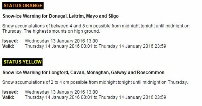
MET ÉIREANN IS forecasting snowfalls (not just ‘wintry showers’) in some areas later today, and two weather warnings are in effect.
The cold snap, meanwhile, is set to last well into next week.
If you’re heading out this morning, the headline advice: wear a heavy coat.
Here’s today’s forecast:
“A cold day ahead: some icy roads this morning and top afternoon temperatures of only 2 to 6 degrees with frost lingering in sheltered areas.
Most areas dry this morning with sunny spells but scattered heavy wintry showers will develop through the day with some falls of snow occurring locally later this afternoon and evening.
Snow accumulations up to 8cm are expected on some areas of Donegal, Leitrim, Mayo and Sligo today.
Accumulations of up to 4cm are forecast for Longford, Cavan, Monaghan, Galway and Roscommon.
The next week
It will be cold and windy tonight with clear spells and scattered sleet and snow showers.
And it will stay very cool indeed over the weekend. As yet, however, there are no widespread heavy snowfalls forecast.
It will dip as low as -4 degrees on Friday night, and down to -6 on Saturday night.
Here’s the outlook:
The forecast is for the cold weather to continue to mid-week with frosty nights and mornings with icy conditions. Cold days as well but dry with sunny spells.
Remember to take extra care if you’re heading out on the road this morning.

To embed this post, copy the code below on your site














have your say