Sign in. It’s quick, free and it’s up to you.
An account is an optional way to support the work we do. Find out more.
Sign in. It’s quick, free and it’s up to you.
An account is an optional way to support the work we do. Find out more.
LAST UPDATE | 28 Oct 2025
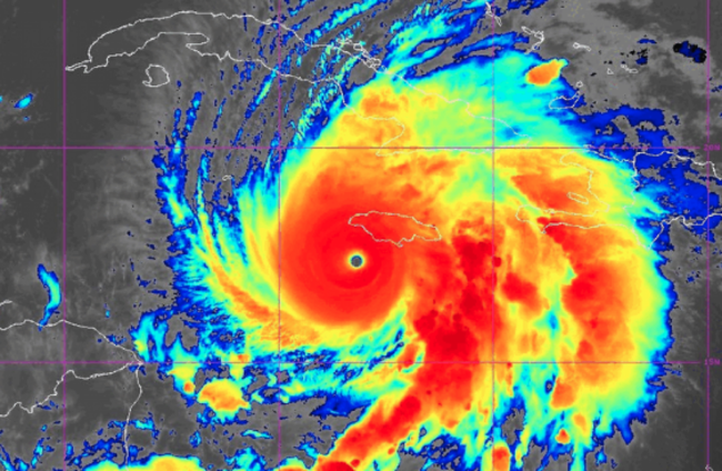
HURRICANE MELISSA IS the most powerful storm seen anywhere in the world so far this year – something experts are putting down to a warming climate.
The remnants of the storm later in the week will likely bring ”plenty of rain and unsettled weather” to Ireland – but it’s too far away to say with certainty yet, according to a meteorologist from Met Éireann.
The Grade Five hurricane is to hit Jamaica today and cause catastrophic damage. It’s then expected to hit Cuba, turn north-east and strike the south-east Bahamas by tomorrow evening.
Professor of Climate Science at Maynooth University, Peter Thorne, said the storm is forecast to start moving out rapidly northeast into the Atlantic ocean – if it impacts Ireland it will likely be at the end of the weekend or early next week.
He said it’s “too soon to tell” what the exact effects will be here as tropical storms can trigger periods of extreme storminess or calm and cold weather.
A meteorologist from the Irish national forecaster told The Journal that by the time the impact of the hurricane reaches Irish shores, it will have gone through so much change that it will look quite different to what the Caribbean is seeing.

“By the time the remnants track across the Atlantic, it could transition into a whole load of things,” the forecaster said.
“It could end up being almost nothing by the time it gets to us. You could never say with certainty what we will expect.”
He said that when hurricanes in the Caribbean move northwards, the cold sea causes them to weaken, and the interaction with different weather systems change the nature of the storm.
“Plenty of our weather comes from transitioning from ex-hurricanes. We get the remnants all the time and that’s not unusual,” he said.
The hurricane will be the most powerful to hit Jamaica since records began 174 years ago.
It jumped from a tropical storm with 110 km/h winds to a 225km/h winds Category Four within 24 hours. It’s since strengthened further into a Category Five, the highest level on the Saffir-Simpson scale.
The US National Hurricane Centre has warned that “catastrophic winds, flash flooding and storm surge” are expected in Jamaica, while the International Red Cross said the storm could impact up to 1.5 million people in Jamaica.
But why is it so strong?
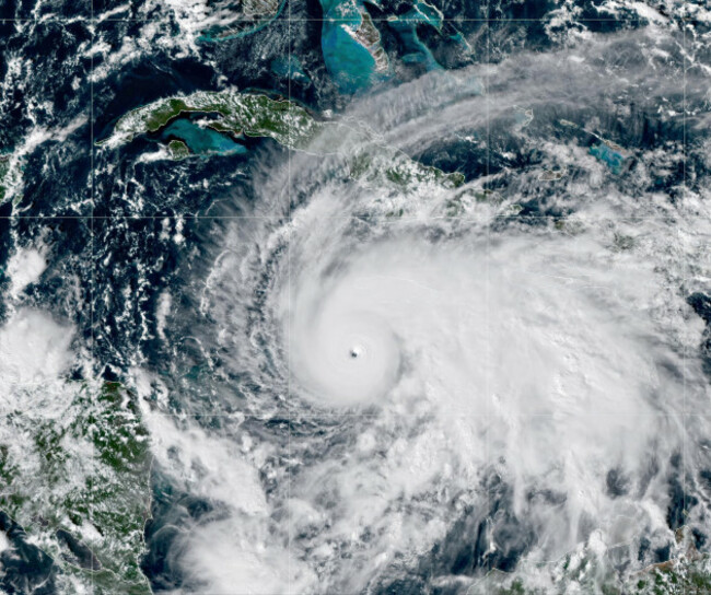
Professor Thorne from Maynooth university said that the heat and lack of wind in the Caribbean has intensified the hurricane.
“The heat of the Caribbean is the rocket fuel,” he said, adding that climate change has “super heated” the ocean.
The storm passed over waters 1.4 degrees Celsius warmer than average for this time of year due to climate change, according to an analysis from non-profit Climate Central.
The non-profit said that these temperatures were at least 500 times more likely due to human-caused warming.
Hurricane Melissa is a slow moving hurricane, which usually tend to die out as they pull up cold water from the deeper parts of the ocean. But Professor Thorne said that as the ocean is now hot to a greater depth that it avoided the usual self-destructing effect.
He said there will be “significant flooding” in Jamaica – something which may cause a high number of deaths.

To embed this post, copy the code below on your site















have your say