Sign in. It’s quick, free and it’s up to you.
An account is an optional way to support the work we do. Find out more.
Sign in. It’s quick, free and it’s up to you.
An account is an optional way to support the work we do. Find out more.
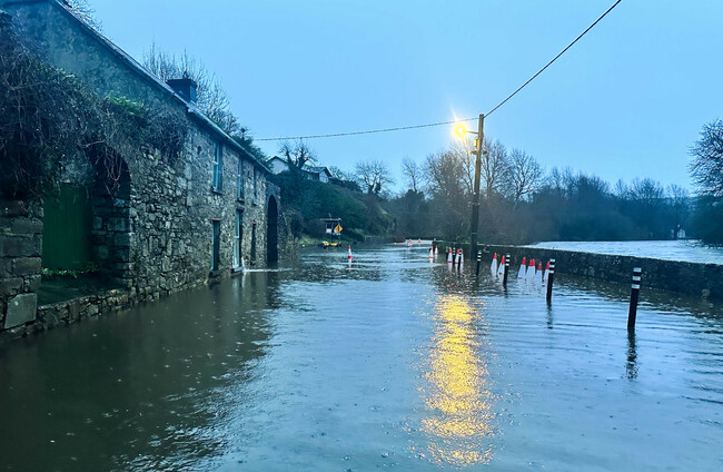
LAST UPDATE | 30 Jan
THE SOUTHEAST OF the country has faced further flooding this evening amid a Status Yellow rain warning.
The warning for counties Carlow, Dublin, Kilkenny, Louth, Wexford, Wicklow and Waterford kicked in at 12pm and will remain in place until midnight.
Met Éireann has warned that further heavy rain and showers, combined with high river levels, is likely to lead to localised flooding, river flooding and difficult travelling conditions.
A Status Yellow rain warning is also in place for Northern Ireland, with the UK Met Office warning that heavy rain could lead to transport disruption and flooding in places.
The wet weather, particularly across the south-east, east and north-east, is expected to worsen conditions after weeks of persistent rain and flooding linked to Storm Chandra.
The National Emergency Coordination Group has said that disruption to essential services “is likely over the coming days”, while severe weather and flooding may impact transport services.
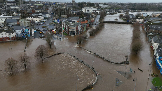
Residents in Co Wexford are on high alert, days after the River Slaney burst its banks and flooded a number of homes and businesses in Enniscorthy.
Updates came earlier from Eoghan Dalton and Jane Moore.
Good afternoon and welcome to our live coverage as parts of the country braces for heavy rainfall and possible further flooding.
Jane Moore here – I’ll be bringing you all the latest weather, transport and travel updates as they happen.
In case you needed a recap, a Status Yellow rain warning is in place for counties Carlow, Dublin, Kilkenny, Louth, Wexford, Wicklow and Waterford until midnight tonight.
Met Éireann has warned that heavy rain and showers falling on saturated ground, along with high river levels, will lead to localised flooding, river flooding and difficult travel conditions.
A Yellow rain warning is also in place for Northern Ireland until 6pm.
With saturated ground conditions & high river levels, further localised flooding is possible.
— Met Éireann (@MetEireann) January 30, 2026
Highest temperatures of 7 to 10C
Yellow rainfall warning in place ➡️https://t.co/w5QtJ1UyEP pic.twitter.com/1DT0LzOrdk
Bad news for any commuters to and from Belfast.
Iarnród Éireann has said that four services have been cancelled due to flooding on the line between Belfast and Dublin.
These are:
As a result of the last cancellation, the 18:59 Grand Canal Dock to Drogheda service has been extended to Newry this evening.
The following services have been CANCELLED today:
— Iarnród Éireann (@IrishRail) January 30, 2026
14:50 Connolly/Belfast
16:00 Belfast/Connolly
18:00 Belfast/Connolly
18:50 Connolly/Belfast - as a result, the 18:59 Grand Canal Dock to Drogheda service has been extended to Newry this evening.
-AP https://t.co/ztPlVHFWOH
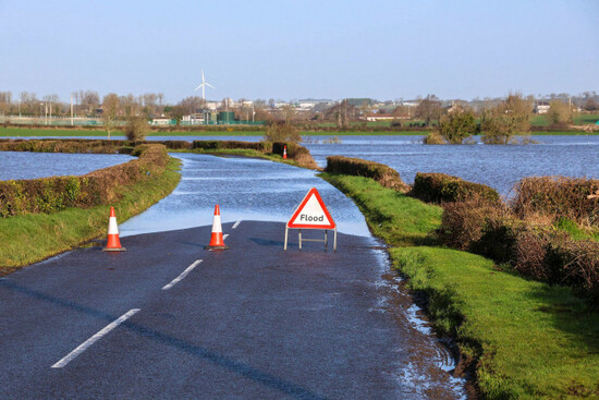
Parts of the east and south-east are still recovering from the flooding caused as a result of Storm Chandra, in particular in Enniscorthy, Co Wexford, where the River Slaney burst its banks.
Research carried out by Met Éireann and the ICARUS climate research centre at Maynooth University has found that flooding like that experienced this week has been made three times more likely due to climate change.
The researchers noted that the one-day rainfall directly from the storm was “not particularly remarkable”.
However, they added that the seven-day accumulated rainfall “made an otherwise relatively uninteresting rainfall event far more devastating from a flooding perspective”.
You can read more here.
It doesn’t look like we’re going to have a break from the wet weather anytime soon.
According to Met Éireann’s extended range forecast - which includes the monthly and seasonal forecasts – the rain is here to stay.
The week from 2-8 February, low pressure to the southwest is likely to result in mixed conditions with higher than average rainfall across most of the country, except for parts of the west and northwest, where it will be below average.
The forecaster said there’s a signal for unsettled conditions to continue the following week. Precipitation anomalies are expected to be below average for most for this time of year, with temperatures also expected to be below average.
There is increasing uncertainty for the week of 16-22 February, though indications are that low pressure will stick around and bring more unsettled conditions.
Little change is indicated for the week after, with wetter than average conditions signalled for most areas apart from the northwest.
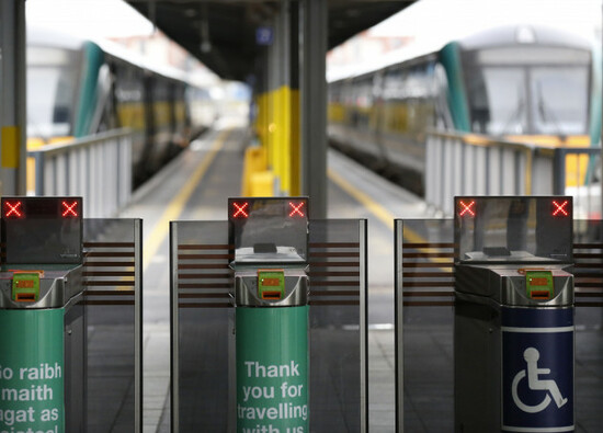
Along with the bad weather, there are major disruptions to train timetables this weekend due to the Bank Holiday.
Iarnród Éireann is carrying out works on tracks and overhead lines on a number of routes from tomorrow through to 2 February.
The routes suspended include Connolly Station to Drogheda, as well as DART services north of Connolly, to Howth and Malahide. Belfast Enterprise services will also be affected.
Dublin Bus and GoAhead will accept rail tickets for affected services.
Iarnród Éireann advised pre-booking for Intercity travel, particularly at the busiest times.
You can find a full list of the affected routes and alternative arrangements here.
Iarnród Éireann has said the Connolly/Belfast line will reopen this evening, with the following services operating:
Update:
— Iarnród Éireann (@IrishRail) January 30, 2026
The Connolly/Belfast line will REOPEN, and train service will operate for the entire route for the following services this evening:
17:50 Connolly to Belfast
18:00 Belfast to Connolly
-AP https://t.co/Zb752f8Hz9
As the east braces for further heavy rain, Wexford County Council has asked people not to park in areas that are prone to flooding.
As the possibility of more flooding increases, please be mindful of where you park your car. In particular, please avoid areas prone to flooding like promenades and quay fronts. pic.twitter.com/iCJH5L5drg
— Wexford County Council (@wexfordcoco) January 30, 2026
The Dublin Racing Festival is due to kick off at Leopardstown this weekend, but it may not go ahead due to the bad weather.
Organisers have said they will inspect the course at 8am tomorrow ahead of the first day of the festival.
Some 22mm of rain fell yesterday and into this morning, taking the total to 193mm in the past two weeks and leaving parts of the hurdle track unfit for racing.
Update from @LeopardstownRC with @ihrb_ie Clerk of the Course, Paddy Graffin ahead of the Dublin Racing Festival
— IHRB (@ihrb_ie) January 30, 2026
Track is fit for racing
Inspection at 8am on Saturday morning
Details following the inspection will be posted on @IHRBRaceday pic.twitter.com/vnRYHOdLQM
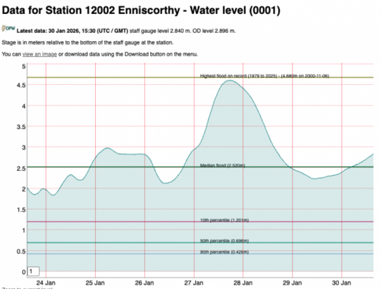
The River Slaney in Enniscorthy is above its median flood level and is continuing to slowly rise – but it’s still far below the volume which caused the property damage seen in the town this week.
According to the Office of Public Works, it is currently at a similar level to 25 January, which while dramatic caused no major disruption.
The River Dodder in Dublin also burst its banks due to Storm Chandra this week, causing flooding along Dodder Road Lower in Rathfarnham.
This was the river at around 11am this morning.
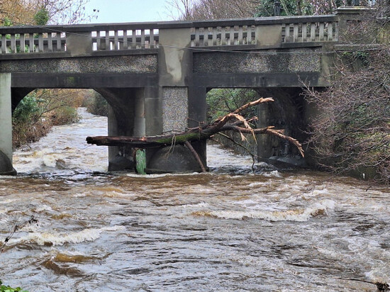
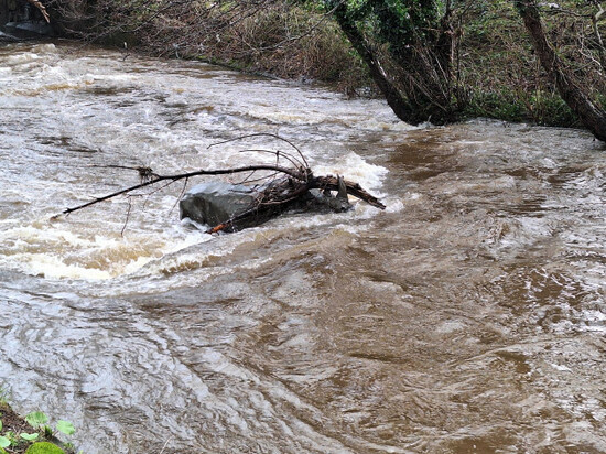
The lifesize bronze statue of an African rhino in the river was also partially visible and carrying a large branch in his horn.
The statue, which can be seen from Classon’s Bridge next to The Dropping Well pub, is a good indicator of how high the river level is.
The Irish Coast Guard is urging people to exercise caution around water this Bank Holiday weekend.
Irish Coast Guard, Water Safety Ireland and the RNLI are urging everyone to check weather and sea conditions before any coastal or water-based activity.
— Irish Coast Guard (@IrishCoastGuard) January 30, 2026
🚨 In an emergency, call 112/999 and ask for the Coast Guard.
Check for weather updates: https://t.co/GC5KPq0XRg pic.twitter.com/WBqJAyVhtT
The Irish Red Cross has set up a dedicated phone helpline manned by staff and volunteers to help people whose home or business has been damaged by floods.
The helpline does two things, according to the Irish Red Cross: it provides a ‘listening ear’ for people, and it also gives information about local authority and government support services.
The helpline will operate today, tomorrow and Sunday, and potentially longer if needed, between 10am and 6pm daily. People can reach it at 01 642 4648.
Wexford County Council chief Eddie Taaffe has said that Enniscorthy is at “significant risk of flooding” ahead of further rain later this evening.
“Unfortunately, water levels are starting to rise continuously now in Enniscorthy, and we still have further rain to come on the Slaney catchment later tonight,” he told RTÉ’s Drivetime programme.
“Obviously we’re hoping it won’t be as bad as before, but we are putting preparations in place, assuming the worst.”
Taaffe said the council has reissued sandbags to any residents who needed more. He said they have crews on standby and have advised residents who availed of emergency accomodation earlier in the week that it is still available to them.
Given the risk involved tonight, it might be wiser if they were to consider moving sooner rather than later before it gets too late.
He urged locals to “remain vigilant” but added that given the information they are receiving, “there’s a very significant risk now at this stage that, unfortunately, we could be in for a repeat of what we saw earlier in the week.”
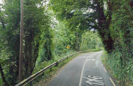
The Road Safety Authority is advising motorists to take care and exercise caution on the road this evening with the Status Yellow rain warnings in place.
RSA spokesperson David Martin told RTÉ’s Drivetime that those in the east of the country should take particular caution when driving.
“People might be traveling on routes that they’re not familiar with. If you do come across a flooded road, I think it’s very important not to attempt to drive through it,” Martin said.
He said flooded roads can appear shallow, but they’re “frequently deeper than you think”.
“The verge may have subsided and there may also be trees or other debris that have fallen. So just our advice is turn around and choose another route.”
The RSA is also advising people to take greater braking distance between themselves and the vehicle in front, particularly on motorways where there is an increased danger of aquaplaning.
Martin said it’s also important that drivers use their dipped headlights at all times and follow recommended routes.
“There may be signs from the Gardaí or the local council saying the road ahead is closed. It’s closed for a good reason. So turn around and follow the recommended route.”
Motorists should also ensure that their tyres are in good condition with the appropriate tread depth, Martin said.
For vulnerable road users such as cyclists and pedestrians, the RSA is advising them to make sure that they are visible by wearing bright clothing and high-vis material, and for pedestrians, to remember to walk on the right hand side of the road facing traffic.
The cut-off date for those living in properties affected by Storm Chandra to apply for Stage 1 of the Emergency Response Payment has been extended to Wednesday, 11 February.
The Department of Social Protection said the payment provides income-tested financial support to those “whose homes are damaged from flooding and severe weather events and who are unable to meet emergency costs for essential needs, household items and structural repair”.
Anyone who wishes to apply for the payment can contact the Community Welfare Service on 0818 60 70 80, or they can download an application form online.
More information about the Emergency Response Payment can be found on the Department’s website or on Citizens Information.
The National Emergency Coordination Group and the Humanitarian Subgroup met again today to prepare for the risk of further flooding today and over the weekend.
The NECG group has said that river and surface water flooding will continue to be a risk over the next few days due to more rainfall, saturated ground conditions and high river levels, especially in the northeast, east and southeast of the country.
However, it warned that flooding is possible in many areas of the country and “the risk is not confined to those areas with yellow rain warnings in place”.
The group also said that disruption to essential services “is likely over the coming days”, while severe weather and flooding may impact transport services.
It is advising the public to check with transport operators before making a journey.
People have also been urged to monitor Met Éireann for weather updates and check local authority websites and social media channels for information on road closures, flooding updates and community alerts.
Local response teams will be on full alert today and throughout the weekend to monitor the situation and ensure that resources are in place for any necessary interventions.
A subgroup of the NECG is also coordinating with the ESB and relevant local authorities “to plan and prepare for the necessary discharge” from the Poulaphouca Reservoir in Co Wicklow over the coming days, and to put mitigation and protection measures in place if needed.
The National Emergency Coordination Group has issued the following public safety advice for the coming days:
Cruagh Road Closed Until Further Notice
Rain run off caused by Storm Chandra has resulted in a section of the retaining wall on Cruagh Road near Rathfarmham collapsing according to South Dublin County Council.
The collapsed section of wall is 150m south of Cruagh Cemetery.
This road is closed and traffic diversions are in place until further notice, to allow a full assessment of the road be undertaken and repair works carried out
Latest from Enniscorthy
There is a “very significant risk of flooding” in Enniscorthy town again tonight and over the next 24 hours,
That’s according to Wexford County Council’s latest update issued in the past few minutes, as they advise that motorists should avoid Enniscorthy town as traffic is currently at a standstill.
“River levels continue to rise in Co Wexford this evening and surface water is building on all routes across the county,” a council spokesperson said.
There has been flooding in Thomastown after the River Nore burst its banks, with photos from the scene showing water lapping the doorways of homes.
Kilkenny County Council has urged people to avoid The Quay in Thomastown, adding that conditions are especially dangerous near flooded riverbanks as water levels can rise suddenly.
Other parts of the county, including Inistioge, Graiguenamanagh and Callan, have all seen flooding today.
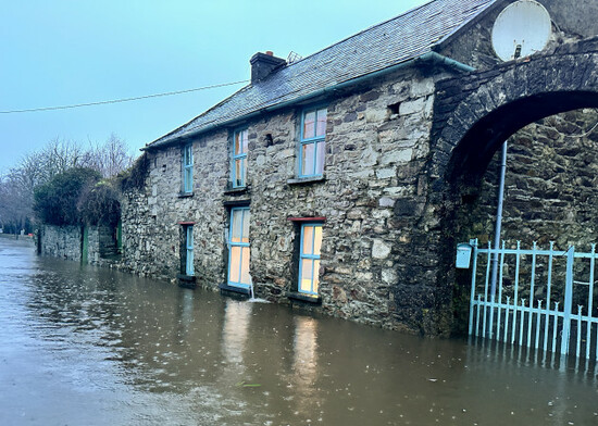
In Co Wexford, the council has said that Our Lady’s Island Lake near Rosslare is currently at risk of flooding.
It has urged motorists to be careful while driving as the water is accumulating in places.
The council has also warned the public that flooded waters “should be treated as contaminated” and that children should not be brought anywhere near flooded areas.
A spokesperson added that “the water is flowing rapidly and there may be underlying manholes that have become dislodged and other debris from lands and the river” as a result.
A contingency plan has been put in place for Dublin Racing Festival at Leopardstown, amid fears that heavy rain will affect the track this weekend.
There’ll be an inspection of the track at 8am tomorrow morning, Saturday, and if it doesn’t pass, then an extra day will be added to the schedule.
More rain is forecast, so it’s likely that tomorrow’s races will be postponed until the Bank Holiday Monday.
The track was flooded on Tuesday when Storm Chandra’s rains swept in, but the ground staff at Leopardstown have been working to stay on top of it.
The before and after @LeopardstownRC
— Joe Seward (@JoeSeward1) January 28, 2026
Remarkable work yesterday from the ground-staff.#StormChandra #leopardstown pic.twitter.com/ZWEWn9l9ey

To embed this post, copy the code below on your site













have your say