Sign in. It’s quick, free and it’s up to you.
An account is an optional way to support the work we do. Find out more.
Sign in. It’s quick, free and it’s up to you.
An account is an optional way to support the work we do. Find out more.
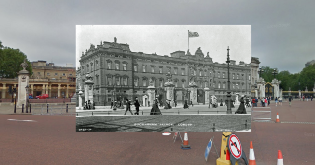
STROLLING AROUND LONDON is something many people have done and many enjoy.
But this map from travel site Expedia allows you to see what strolling around London since the turn of the last century would have been like.
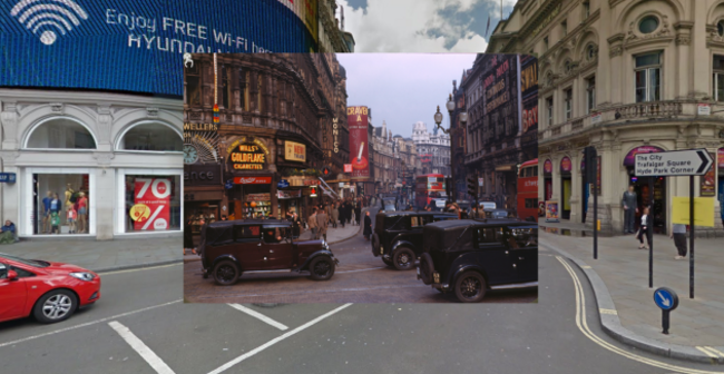
The Historic London graphic from Expedia UK allows users to explore the history of 14 areas in the British capital, including Whitehall, Clapham, Stockwell, Cheapside, and Brixton.
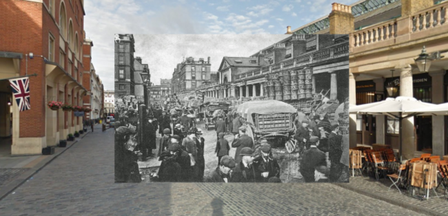
Photos of tourist spots like Covent Garden, Piccadilly Circus, and Oxford Street, as well as landmarks such as Westminster Abbey, and Harrods are also featured.
The graphic was created using Google Street View technology, which provides modern-day footage of the city, overlaid with photos of London from over 100 years ago.

To embed this post, copy the code below on your site















have your say