Sign in. It’s quick, free and it’s up to you.
An account is an optional way to support the work we do. Find out more.
Sign in. It’s quick, free and it’s up to you.
An account is an optional way to support the work we do. Find out more.
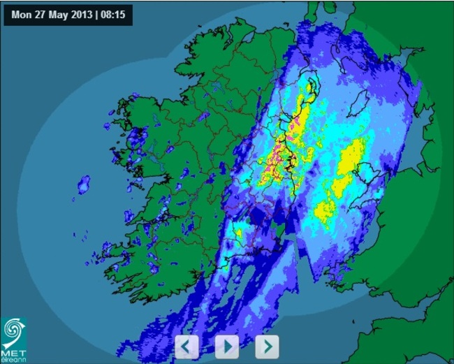
Hope you’re having fun up there Donegal. (Met.ie rainfall radar as of 8.15am)
HOPE YOU DIDN’T pack the umbrella and Macs away in the excitement of our recent sunny spells because they’ll be needed from today.
The weather folk over at Met Éireann believe there will be showers every day this week, describing expected conditions as “much fresher than of late”.
As we already know, it is “very wet and windy” in eastern areas this morning but that rain is expected to become “fairly widespread” and heavy by the afternoon, with a risk of hail and thunder too. Delightful.
Top temperatures will reach just 11 to 14 C.
Although we might get some bright, sunny spells tomorrow they will be short-lived because it will be “very showery overall”. Heavy and prolonged showers are expected in the west (sorry). Also, the risk of thunder and hail will not have gone away. Of course.
The remainder of the week is predicted to be a mix of sunny spells and shower activity.
Present indications for Friday suggest that a spell of rain will move off the Atlantic during the day and will cross the country later or overnight. But amounts of rainfall should be small and there will be some bright or sunny spells at times too. Temperatures are expected to drop back to between the low and mid teens.
So there you have it. An Irish summer. Enjoy.

To embed this post, copy the code below on your site















have your say