Sign in. It’s quick, free and it’s up to you.
An account is an optional way to support the work we do. Find out more.
Sign in. It’s quick, free and it’s up to you.
An account is an optional way to support the work we do. Find out more.
LAST UPDATE | 1 Apr
MET ÉIREANN HAS issued a weather advisory over the Easter break and said warnings are likely to be issued, with stormy weather possible in places on Saturday.
The weather advisory comes into place at midnight on Friday and will remain in place until midnight on Tuesday, 7 April.
Unsettled and mixed weather is forecast for over Easter, and it will be windy or possibly stormy in places on Saturday.
🔴 *NOT APRIL FOOLS* 🔴
— Weather Alerts Ireland ⚡️☔️ (@IrelandAlerts) April 1, 2026
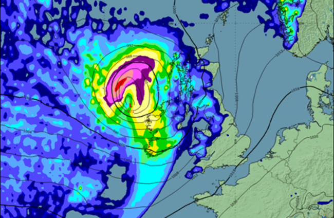
Storm Risk for Saturday!
An awkward day to write this but this is not April Fools.... I promise unless the charts are fooling me....
The morning models are forecasting a large storm (I did post the other day of a risk of storms) for Saturday into… pic.twitter.com/EhDS2bJIzr
There is potential for some severe or damaging west to southwest gusts and coastal flooding is likely, especially around high tide times and in exposed, low-lying locations along the Atlantic coastal counties.
Meanwhile, high Spring Tides will coincide with storm surge and persistent onshore winds will further increase the risk of coastal flooding, with areas along the west and north coasts are particularly vulnerable.
Elsewhere, strong onshore winds, combined with high waves, may lead to wave overtopping and flooding in low-lying and exposed coastal areas.
Met Éireann has advised it is likely to issue weather warnings over Easter, while a warning has already been issued for the North.
The UK Met Office has put in place a Status Yellow wind warning across Northern Ireland from 6pm Saturday until 12 noon on Sunday.
In its meteorologist’s commentary, Met Éireann said there will be unsettled weather over Easter but that there is “uncertainty in the details”.
It warned of the potential for disruptive weather but with “increased exposure as people head out for the extended Easter weekend”.
It added that updated guidance will be issued when the “certainties increase”.
Current indications are that it will turn windy on Good Friday and there could be some “strong winds, along with showery outbreaks of rain”.
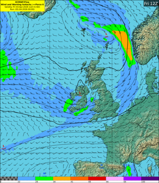
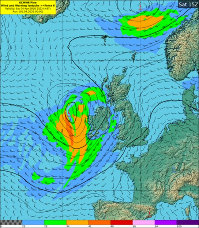
It will then turn wet and windy on Saturday, with outbreaks of heavy rain and spot flooding possible.
There is also potential for some very strong south-westerly winds to occur later in the day, most likely for western and northwestern parts, while high Spring Tides, storm surge and persistent onshore winds will further increase the risk of coastal flooding.
On Easter Sunday, it is currently set to be a breezy and showery day, and some of the showers will fall as sleet, mainly in the west and north, with the chance of some falls of snow on high ground.
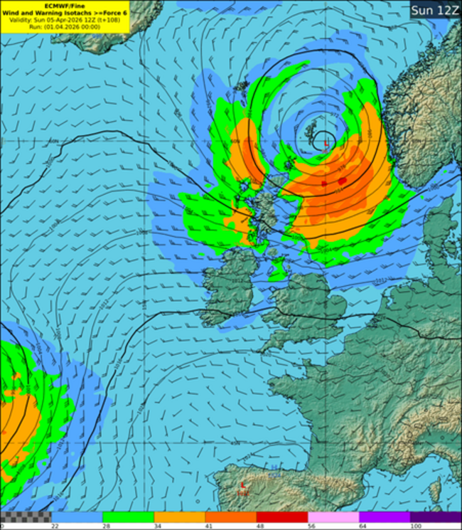
Strong onshore winds early on Sunday morning, combined with high waves, may lead to wave overtopping and flooding in low-lying and exposed coastal areas.
And on Monday, another windy day could be in store but current indications suggest the worst of the wind and rain will stay offshore.
Looking at today’s forecast, it will be dry for most this evening, with late sunshine.
But it will then turn cold overnight, with temperatures of -1 to 3 degrees, with some frost and ice setting in.
Tomorrow, Thursday, will also start cold and mostly cloudy, though some brighter spells are expected in the east and southeast.
Rain will move into the west later in the morning and spread across the country through the afternoon, with temperatures only reaching 7 to 10 degrees.
Looking ahead to the Easter weekend, Met Éireann says a more unsettled pattern will take hold as Atlantic weather systems move in.
-With additional reporting from Diarmuid Pepper

To embed this post, copy the code below on your site












have your say