Sign in. It’s quick, free and it’s up to you.
An account is an optional way to support the work we do. Find out more.
Sign in. It’s quick, free and it’s up to you.
An account is an optional way to support the work we do. Find out more.
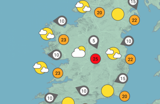
THIS WEEKEND MIGHT have been a washout for many, but fear not – Met Éireann has forecast long spells of sunshine and high temperatures for the coming week.
Parts of Dublin saw flooding after heavy rain yesterday, but this weekend’s mist and fog should clear quickly tomorrow, with highs of 19 to 24 degrees.
The national forecaster has said that we can expect warm and dry conditions on Tuesday, with temperatures peaking at 21 to 24 degrees Celsius.
Wednesday and Thursday will be similarly toasty, with highs of 21 to 25 degrees, and Friday will bring the “odd shower”. Met Éireann has said that “early indications suggest that the settled spell will continue into the weekend, with mostly dry weather though there will be showers at times. Temperatures in the high teens or low twenties.”
The good weather will have to stretch into next week to be deemed a heatwave, however – Met Éireann’s head of forecasting Evelyn Cusack told The Journal during Ireland’s most recent spell of good weather last month that high temperatures can only be called a heatwave if five consecutive days have a maximum temperature of over 25 degrees.
Severe flooding hit areas of South Dublin yesterday. After bursts of heavy rain, gardaí issued a traffic alert for Roebuck Road in Dublin 14, which is “impassable” due to flooding.
The Dundrum Town shopping centre was partly flooded on its ground floor and outside area.
Met Éireann also issued a blight advisory for Ireland earlier this week, which remains in effect: “Weather conditions conducive to the spread of potato blight will develop countrywide on Friday, and will continue over the weekend.”

To embed this post, copy the code below on your site














have your say