Sign in. It’s quick, free and it’s up to you.
An account is an optional way to support the work we do. Find out more.
Sign in. It’s quick, free and it’s up to you.
An account is an optional way to support the work we do. Find out more.
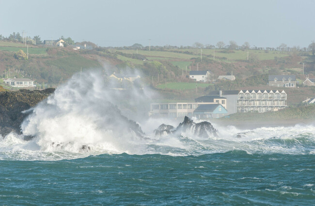
A STATUS ORANGE rainfall warning was in place for Cork and Kerry early yesterday amid Storm Babet, followed by a Status Yellow warning across the country.
Wexford, Wicklow and Waterford were also subject to an Orange warning for several hours in the afternoon.
Parts of the affected counties were battered by heavy rainfall, such as Midleton in Co Cork, where members of the Defence Forces were deployed as buildings flooded and roads were cut off.
Some locals and representatives have questioned whether a Status Red weather warning should have been sounded. ”Met Éireann must urgently explain why no red level weather warning was issued,” Cork East TD James O’Connor wrote on social media.
In Scotland, which was also hit by the storm, a Red warning was issued for the first time since Storm Denis in 2020.
Met Éireann’s Chief Hydrometeorologist Eoin Sherlock has explained how the national forecaster decides what type of warning to issue ahead of an extreme weather event.
Speaking on RTÉ Radio One’s Morning Ireland earlier today, Sherlock said that Met Éireann uses Irish and European weather models to inform its predictions.
In the case of Storm Babet, the model guidance was suggesting that it would be Orange warning conditions, he said.
There were a couple of weather stations where it “crept into Red territory”, he said, but most were within the threshold for Orange or even Yellow warnings.
“The way we do it is we look at, is it going to be a widespread event? Will it affect all of Co Cork?” Sherlock said.
I am in Midleton, Co Cork reporting on the devastating floods here yesterday. Clean up under way but a lot of the locals I spoke to are angry that a lack of flood defences and an inadequate warning left them with little time to respond.
— Niall O’Connor (@NiallJournal_ie) October 19, 2023
Follow on @thejournal_ie for more. pic.twitter.com/OS26UKuWwi
Met Éireann describes Yellow warnings as “not unusual weather, localised danger”; Orange as “infrequent, dangerous/disruptive” and Red as “rare, extremely dangerous/destructive”.
“From our perspective, Orange is the second highest warning alert,” Sherlock said.
“We issue storm names when we expect Orange level wind warnings and that’s partly to help the public understand what’s coming, so if we issue an Orange warning for wind or for rain, it really is [a situation where] ‘I better check out my surroundings, I better think hard about what’s going to come.
Sherlock said that the thresholds for weather warnings and how Met Éireann communicates about them will change as Ireland’s long-term climate also changes.
“Every 30 years we look at the climate and for every 10 years we look at the climate averages. What that means is we look at what’s happened over the last 30 years -0 so that’s 1991 to 2020 — and we do some analysis,” he explained.
A Red warning would probably correspond to the highest 1 or 2% of rainfall events. An Orange warning would be probably the 95th percentile.
“The climate has changed, there’s no doubt about that, that’s unequivocal. We’ve gotten warmer; we’ve seen temperatures increase by point seven degrees since the last round of climate averages in the last 10 years,” Sherlock said.
“We can expect more extreme rainfall because the temperature has increased. So, what we’re doing now is we’re looking at the thresholds that we have for the warnings and are going to change them in reflection of what’s happening in the climate,” he said.
“For example, the Yellow wind warnings, we’ll move up the lower threshold in particular by five kilometres per hour, so I think it’s 50 to up to 55 kilometres per hour. We’ll still warn people about that in our forecasts, but for the weather warnings, the threshold [will be different].
“Another thing that we’re trying to do is to look at not only what the weather will be but what the weather will do. If you’ve been looking at our warnings over the last couple of days, we have been warning about flooding and we’ve been warning about difficult driving conditions.
“Maybe people don’t understand what 80 kilometre per hour winds are, but if we if we can inform people that there’s going to be flooding, they can take the necessary steps.
“As a quick recap: Orange is quite dangerous. There’s only one or two millimetres between an Orange rainfall warning and a Red.”

To embed this post, copy the code below on your site












have your say