Sign in. It’s quick, free and it’s up to you.
An account is an optional way to support the work we do. Find out more.
Sign in. It’s quick, free and it’s up to you.
An account is an optional way to support the work we do. Find out more.
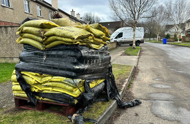
MET ÉIREANN HAS warned that “even moderate rainfall” could be enough to trigger further flooding in counties in the southeast, Kildare and Dublin.
Over the same period, a Status Yellow alert will be in place across Carlow, Dublin, Kildare, Kilkenny, Laois, Louth, Wexford, Monaghan and Tipperary.
The forecaster today published its meteorologist’s commentary in relation to heavy rainfall which will come overnight and into Friday.
In its meteorologist’s commentary, Met Éireann noted that over the past two weeks, the south and east have had the largest deviations from the average rainfall amounts.
Wexford has experienced close to 160 millimetres in the past two weeks, while there has been over 112 millimetres of rain in Dublin, more than four times the average rainfall over the past 14 days.
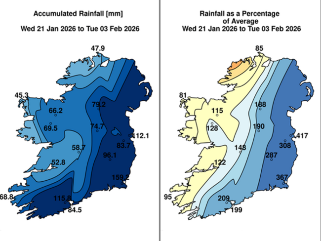
Met Éireann said the south and east of the country looks set to continue to be affected by above average rainfall amounts, while western and northwestern parts are expected to see generally average or below average rainfall accumulations.
In its climate statement for January also published today, Met Éireann found that last month was the second wettest January on record in Dublin.
Meanwhile, Wexford had its wettest three consecutive months on record with heavy rainfall across November, December, and January.
January’s wettest day was also recorded at Johnstown Castle in Co Wexford, with 37.3 mm on Friday, 30 January.
This was also the highest daily rainfall at Johnstown Castle since 1979.
After last week’s heavy rainfall, many rivers remain close to or above bank-full and Met Éireann adds that saturated ground conditions have left catchments “highly sensitive to any additional rainfall”.
While most rivers have now peaked or stabilised – and some have begun to recede – Met Éireann noted that further rainfall yesterday and overnight along the south and east coasts “caused slight rises in river levels in these areas”.
And while today provided a “brief respite”, further heavy rain is to come tomorrow and into Friday.
Met Éireann said that “given current river and ground conditions, even moderate rainfall could trigger further localised flooding, particularly in fast-responding catchments and downstream of the Wicklow Mountains – including in counties in the Southeast, Kildare and Dublin”.
Met Éireann also warned that high spring tides over the coming days, combined with strong onshore winds and storm surge, will increase the risk of wave overtopping and coastal flooding in exposed areas.
Elevated coastal water levels will also restrict river discharge, heightening flood risk in low-lying coastal and estuarine areas, especially around times of high tide.

To embed this post, copy the code below on your site














have your say