Sign in. It’s quick, free and it’s up to you.
An account is an optional way to support the work we do. Find out more.
Sign in. It’s quick, free and it’s up to you.
An account is an optional way to support the work we do. Find out more.
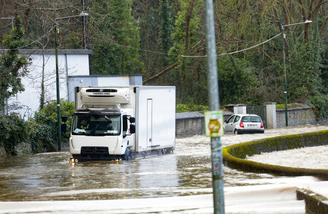
FORECASTERS SAY WIDESPREAD flooding across the east and south-east during Storm Chandra was caused by a combination of saturated ground, swollen rivers, the storm’s path and, in some areas, tidal conditions.
While rainfall totals for January were above average, Met Éireann data shows they were not unprecedented by historical standards.
Instead, officials say it was the volume of rain that fell in the weeks leading up to the storm, combined with where and how Chandra tracked, that pushed rivers beyond their limits.
According to Met Éireann, parts of the south and east of the country saw three to four times their average monthly rainfall over the past week alone.
River level data illustrates the scale of the flooding more starkly than rainfall totals.
On the River Dodder in Dublin, water levels rose far beyond typical flood thresholds.
At Waldron’s Bridge, where the median flood level is just 0.173 metres, levels peaked at 1.952 metres at 7.15am yesterday, according to figures recorded by the Office of Public Works (OPW).
Further downstream at Anglesea Road, the median flood level is 1.453 metres.
Water levels there surged to around 2.815 metres at 8am yesterday, well above the highest flood level previously recorded at that gauge.
In Co Wicklow, the Dargle River at Powerscourt House also exceeded recent records.
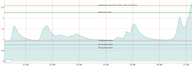
The median flood level at the site is 2.252 metres, but readings reached 2.67 metres yesterday morning, surpassing the previous high of 2.578 metres recorded in August 2023.
In Co Wexford, the River Slaney burst its banks in Enniscorthy, forcing evacuations, closing roads and inundating homes and businesses across the town.
The River Fane, which burst its banks in Co Louth, also reached record levels never before recorded.
Nationally, provisional Met Éireann figures show average rainfall for January standing at roughly 125 to 130 millimetres.
That is higher than January last year (117.3mm) and January 2024 (107.7mm), but remains well below some of the wetter Januarys on record.
January 2018, for example, recorded an average of 197mm nationwide, while January 2016 saw 184.2mm.
January 2022, by contrast, was notably dry, with just 60.4mm recorded on average.
However, rainfall totals varied sharply by location.
At Johnstown Castle in Co Wexford (the closest Met Éireann station to Enniscorthy), around 101mm of rain fell in just the last nine days, equalling the total average monthly rainfall for the region.
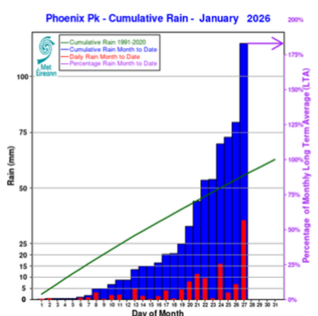
In Dublin’s Phoenix Park (the nearest Met Éireann station to the River Dodder), more than 63mm fell in the last six days alone, surpassing the avarage monthly rainfall figures for the region (62.8mm).
So far, 114.9mm of rainfall has been recorded in the Phoenix park this month.
‘The worst has already occurred’
Met Éireann meteorologist Aoife Kealy said the heaviest rainfall associated with Storm Chandra had already passed, but warned that impacts would linger because of how wet conditions were before the storm arrived.
“The worst of the rainfall has actually already occurred,” Kealy told The Journal yesterday.
Kealy said conditions would gradually improve, but river levels and surface flooding would be slow to recede.
“Even if it’s not actively raining, there can still be significant impacts out there,” she said.

Kealy added that parts of the south and east had seen three to four times their average rainfall over the past seven days alone.
“The big thing in this case was the antecedent conditions,” Kealy said.
“It has been so wet in the run-up to the storm that rainfall, which otherwise may not have caused an issue, did cause an issue in this case.”
Keith Leonard, National Director for Fire and Emergency Management, said the flooding was the result of several compounding factors.
“There’s probably two main factors,” Leonard said, speaking on RTÉ’s Morning Ireland.
“One was just the amount of rain, we’ve had about 240% of the rainfall that would normally have occurred over the last two weeks.”
“On top of that, we had the effects of the storm and how it tracked across the east of the country, and then we had some tidal lock issues with very high tides on Monday night into Tuesday.”
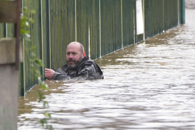
Leonard said the combination of saturated ground, swollen rivers, storm rainfall and tidal conditions led to “severe flooding right across that eastern coast”.
Risks remain as waters recede slowly
While January rainfall this year does not rank among Ireland’s wettest on record, Met Éireann has stressed that winter storms are a normal feature of the Irish climate, and that flood risks rise sharply when rivers are already near capacity.
Storm Chandra was unusual not for rainfall totals alone, but for how heavily it impacted the east and south-east, regions that are typically drier than the Atlantic-exposed west.
With further showers forecast and ground conditions still near saturation, authorities have warned that flooding risks will persist in the days ahead, even as the worst of the rain clears.

To embed this post, copy the code below on your site













have your say