Sign in. It’s quick, free and it’s up to you.
An account is an optional way to support the work we do. Find out more.
Sign in. It’s quick, free and it’s up to you.
An account is an optional way to support the work we do. Find out more.
LAST UPDATE | 8 Jan
THE ARRIVAL OF Storm Goretti won’t do anything to ease anyone’s January Blues here in Ireland – but the worst impact is to be felt in Britain and on the continent.
The impact of the system is now beginning to be felt, with a Status Yellow warning for snow and rain in effect since midday in:
It lasts until 8pm this evening.
Met Éireann’s latest forecast says it will be cloudy with further outbreaks of rain and drizzle this afternoon, mainly affecting Munster and southern and eastern parts of Leinster. The rain will turn heavy at times, especially further to the south.
According to the weather service there’ll be some sleet too and a chance of a little snow, mainly over higher ground.
“It’ll be mostly dry further north, with just a few showers and the precipitation in the south will start to clear eastwards this evening,” the latest forecast says.
There’ll be the odd wintry shower tonight in some areas and will be another cold night, with the mercury dipping as low as minus three.
Rain in the SW🌧️ early this morning will extend N, turning heavy at times in the S☔️ with freshening northerly winds & the chance of some sleet or snow🌨️.
— Met Éireann (@MetEireann) January 8, 2026
The rain will become confined to the SE later.
Largely dry for Ulster though with just some showers🌦️.
Highs🌡️ of 2 to 6°C pic.twitter.com/xnNnvTbi93
A rare red warning for “dangerous, stormy” winds has been issued by the Met Office for south-west England, with Storm Goretti set to bring 160 km/h gusts.
The warning, from 4pm until 11pm, says “violent gusts” over two to three hours will hit parts of Cornwall and the Isles of Scilly.
The warning says people should expect damage to buildings and homes, very large waves, flying debris resulting in danger to life, power cuts and public transport cancellations.
The storm, named by French weather forecaster Meteo France, has been described as a “multi-hazard event” by the Met Office, with as much of 30cm of snow possible for parts of Britain.
Weather warnings have been issued for snow, wind, rain and ice across the country ahead of likely “disruption and dangerous travelling conditions”.
Further east, more than 1,000 stranded passengers spent the night at Amsterdam’s Schiphol Airport as snow and ice grounded hundreds of flights and choked roads and railways.
The busy international airport set up hundreds of field beds overnight and served breakfast to weary travellers as staff worked to clear snow from runways and de-ice planes.
Flights have also been impacted at other airports on the continent, including at Paris Charles de Gaulle where 100 were cancelled yesterday.
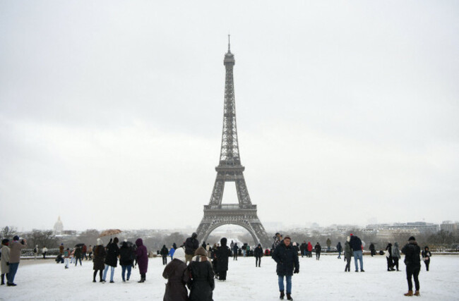
French authorities advised people to work from home and avoid using their cars in the snow-hit regions.
In Paris, a skier slid along the snowy bank of the Seine river and roads and parks around the Eiffel Tower and Louvre Museum were blanketed in snow, which also snarled traffic in parts of France.
- With reporting from Press Association

To embed this post, copy the code below on your site










have your say