Sign in. It’s quick, free and it’s up to you.
An account is an optional way to support the work we do. Find out more.
Sign in. It’s quick, free and it’s up to you.
An account is an optional way to support the work we do. Find out more.
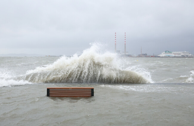
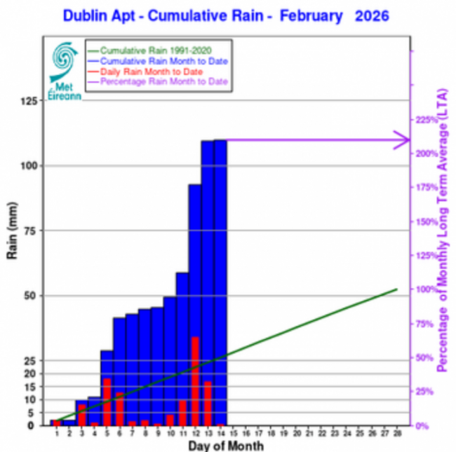
MORE RAIN HAS fallen at Dublin Airport in the first two weeks of February than during the entire month last year.
As of 14 February, 110mm of rainfall was recorded at Dublin Airport – the total rainfall throughout all of February last year was 48mm.
It’s also more than double the long-term average of 52mm – the long-term average is the period from 1981-2010.
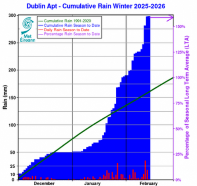
Dublin Airport also saw close to double the amount of rainfall last month (137mm) than it did during the same period last year (73mm), and rainfall last month was more than double the long-term average (62mm).
Last Friday, some roads to Dublin Airport were closed or “trickier to navigate than usual” due to heavy rainfall.
In the 30 hours up to lunchtime on Friday, 51mm of rain fell at Dublin Airport - more rainfall than the entire month of February last year.
Due to heavy rainfall overnight, some roads leading to Dublin Airport are closed or trickier than usual to navigate this morning. Drivers are advised to follow local diversion signage & to take extra care on the roads.
— Dublin Airport (@DublinAirport) February 13, 2026
Flight operations at Dublin Airport are running as normal. pic.twitter.com/rcGViVtNHU
Meanwhile, Met Éireann forecasts that there’s more rain to come this week.
Today got off to a blustery start, with widespread showers at first, turning heavy in places.
Drier conditions and sunny spells will slowly spread from the north through the afternoon as showers ease.
However, heavier showers will continue in Munster though tonight will be generally dry, with just isolated showers which may turn wintry on high ground in the northwest.
There will be a cold start to tomorrow, with frost and ice lingering at first.
A dry day for most but cloud will thicken from the southwest through the day, with rain and drizzle gradually spreading across Munster, possibly falling as sleet on high ground.
It will become wet and windy overnight on Tuesday and into Wednesday, though.
The rain on Wednesday morning will fall as sleet in parts of the north and northeast at first and rain will linger in the east and north for much of the day, but elsewhere will turn brighter with scattered showers.
Further scattered outbreaks of rain are in store for Wednesday night, though these will gradually ease as the night progresses.
Thursday will start cloudy, with outbreaks of rain and drizzle.
It will then slowly brighten up from the west as the day goes on but with scattered showers and sunny spells spreading eastwards.
Friday meanwhile will be dull and blustery, with rain and drizzle spreading eastwards across the country early on, followed by showers and sunny spells later in the afternoon, though some showers may turn heavy.
Current indications for the weekend suggest further outbreaks of rain, with the best chance of dry spells in the south.

To embed this post, copy the code below on your site













have your say