Sign in. It’s quick, free and it’s up to you.
An account is an optional way to support the work we do. Find out more.
Sign in. It’s quick, free and it’s up to you.
An account is an optional way to support the work we do. Find out more.
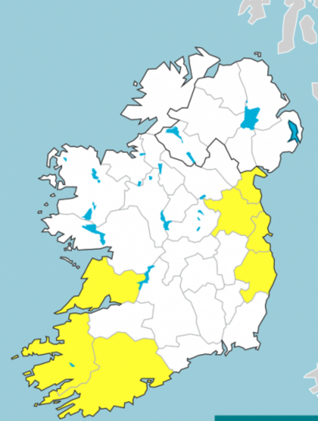
WIND AND RAINFALL warnings are in place in numerous counties around the country this morning.
A Status Yellow rainfall warning is in place in Dublin, Louth, Wicklow and Meath until 2pm this afternoon.
Met Éireann has warned that heavy downpours last night and this morning may result in some river and spot flooding.
A Status Yellow wind warning is also in place in Clare, Cork and Kerry. This warning will remain valid until midday today.
The forecaster says very windy conditions are expected to develop in parts of Munster this morning.
Southerly winds veering west to northwest are to reach mean speeds of 55 to 65km/h at times, with gusts of 90 to 110km/h, highest in coastal areas and on exposed hills and mountains where winds may temporarily exceed these thresholds.
“Given the time of year with many trees in full leaf, there is a greater potential for wind related impacts,” Met Éireann has said.
Highest temperatures today are to range between 11 to 14 degrees.
Looking ahead, it’s forecast to be cold and blustery overnight with clear spells and showers, some of which will be heavy and possibly thundery in Atlantic coastal counties.
It’s due to be fresh and breezy tomorrow with sunny spells and scattered showers.
The showers are to become increasingly isolate later in the day. However, it’s due to turn cloudier in the west and southwest by evening with a chance of rain before dark.

To embed this post, copy the code below on your site













have your say