Sign in. It’s quick, free and it’s up to you.
An account is an optional way to support the work we do. Find out more.
Sign in. It’s quick, free and it’s up to you.
An account is an optional way to support the work we do. Find out more.
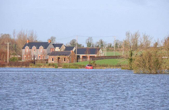
FRESH RAIN WARNINGS entered force for seven counties in the east and south-east at midday, with Met Éireann warning that further flooding is likely.
Heavy rain is falling on already saturated ground and high river levels persist, the forecaster said.
A Status Yellow rain warning is also in place for Northern Ireland, with the UK Met Office warning that heavy rain could lead to transport disruption and flooding in places.
For counties Carlow, Dublin, Kilkenny, Louth, Wexford, Wicklow and Waterford, a Status Yellow rain warning entered force at midday and will remain in place until midnight.
❗️Timing update⚠️Rain Warning🟡🌧️
— Met Éireann (@MetEireann) January 30, 2026
➡️Carlow Dublin Kilkenny Louth Wexford Wicklow Waterford
⏳12:00 Fri to 00:00 Sat
‼️Water has limited capacity to soak into the ground, so runoff may increase quickly especially in low lying or poorly drained areas⚠️
ℹ️https://t.co/w5QtJ1UyEP pic.twitter.com/h5UiVU9vVf
Met Éireann has warned that the rain could cause localised flooding, river flooding and difficult travel conditions. The forecaster said further rainfall, particularly across the south-east, east and north-east, could worsen conditions following a period of persistent rain and flooding linked to Storm Chandra.
Rain will extend to most areas of the country tonight, apart from the south-west, where there will be clear spells and scattered showers.
In Northern Ireland, train operator Translink said it is operating a reduced timetable on the Belfast–Dublin route due to flooding.
#TRAIN #ENT❗Due to flooding on the line between Belfast & Dublin, a reduced timetable is in place today, Friday January 30th.
— Enterprise Train (@EnterpriseTrain) January 30, 2026
Bus transfers will operate to Newry- please allow extra time for your journey.
ℹ️ Click here for further details 👉 https://t.co/nTtZDuNYJ6
Speaking on RTÉ Radio’s Morning Ireland, Met Éireann meteorologist Linda Hughes said the country has seen “very high accumulations of rainfall” in recent weeks, with little let-up since the storm.
“There’s been no break since Storm Chandra and another spell of rain is coming in,” Hughes said.
“While rivers did decrease, further rain on top of that now is going to cause some further issues.”
Hughes said another band of heavy rain is expected to move in from the south-east around midday, spreading across most of Leinster and eastern parts of Munster through the afternoon and evening.
“We’re talking about 30 to 40 millimetres in these areas, possibly higher, particularly over higher elevations,” Hughes said.
“This will be a persistent spell of rain rather than showers, so it’s going to be a very wet afternoon and evening.”
Local authorities remain on high alert, particularly in Co Wexford, where flooding concerns remain acute along the River Slaney following significant rainfall last week.
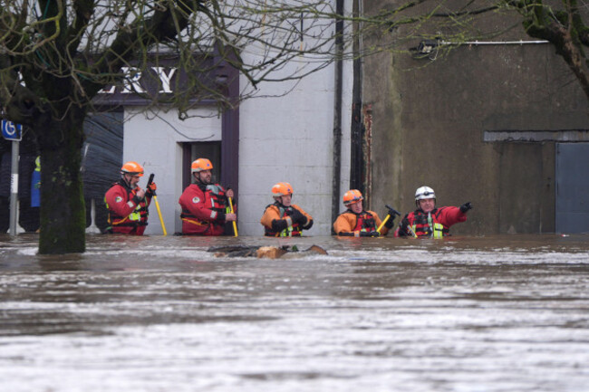
Wexford County Council said there is a “continued high risk for flooding” in Enniscorthy and Bunclody through the bank holiday weekend, noting that nearly 80mm of rain fell in the county between 22 and 28 January.
In South Dublin, the county council said flooding risks remain due to saturated ground and high river levels, with crews continuing clean-up work and flood protection preparations.
Water levels at parts of the River Dodder once again surpassed average flood levels early this morning.
The National Emergency Co-ordination Group has urged the public to remain vigilant, warning that flooding risks are expected to continue into the long weekend.

To embed this post, copy the code below on your site

















have your say